

NHC has issued hurricane and tropical storm watches for the US Gulf Coast – that means hurricane conditions are possible within 48 hours: Key messages regarding Tropical Storm Isaias (en Español: Mensajes Claves). Here’s the watch/warning map:

And latest TAOS(tm) TC/Lachesis impact estimate:
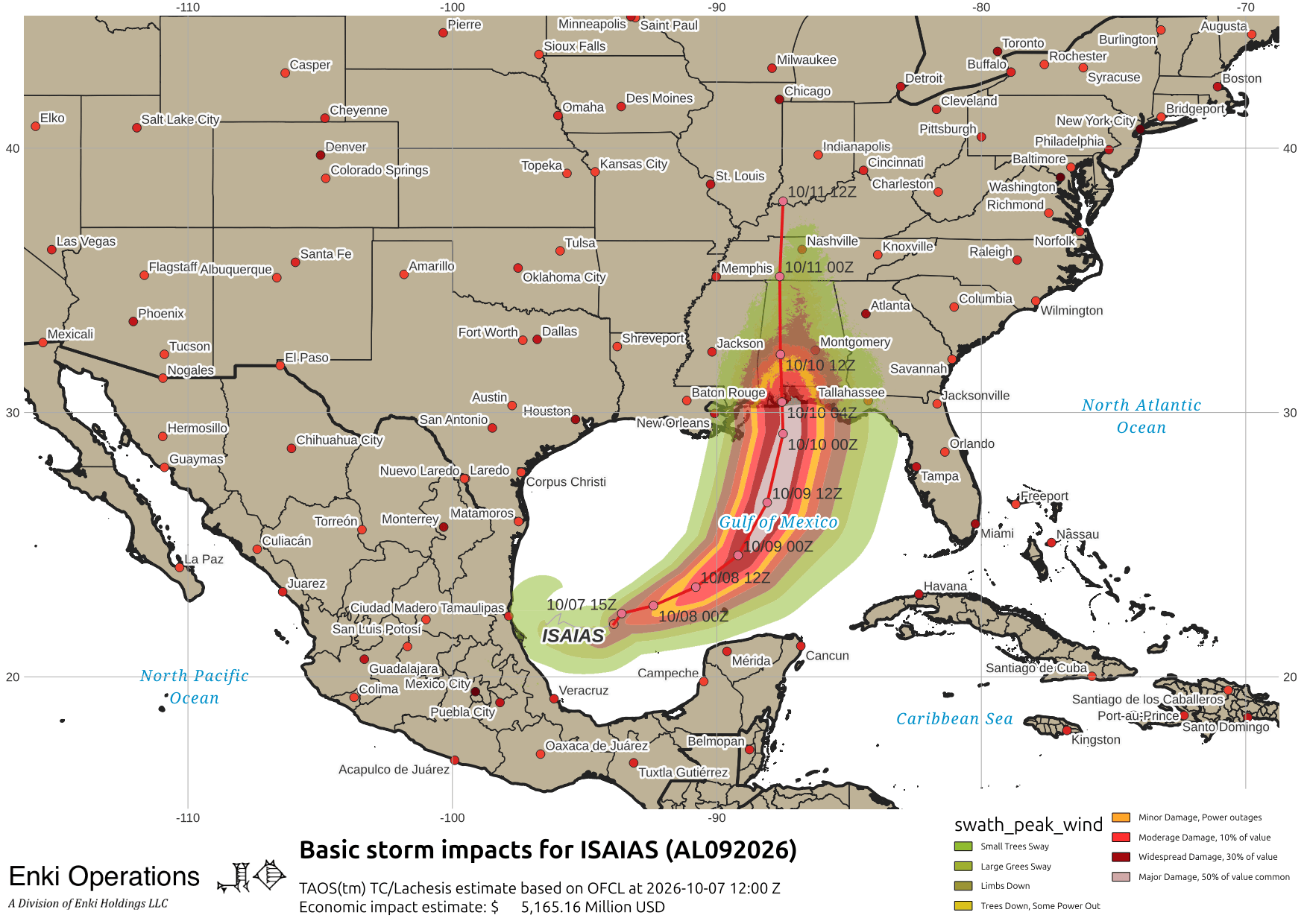
Tracking has shifted a bit east, but still within the area targeted as of this morning:
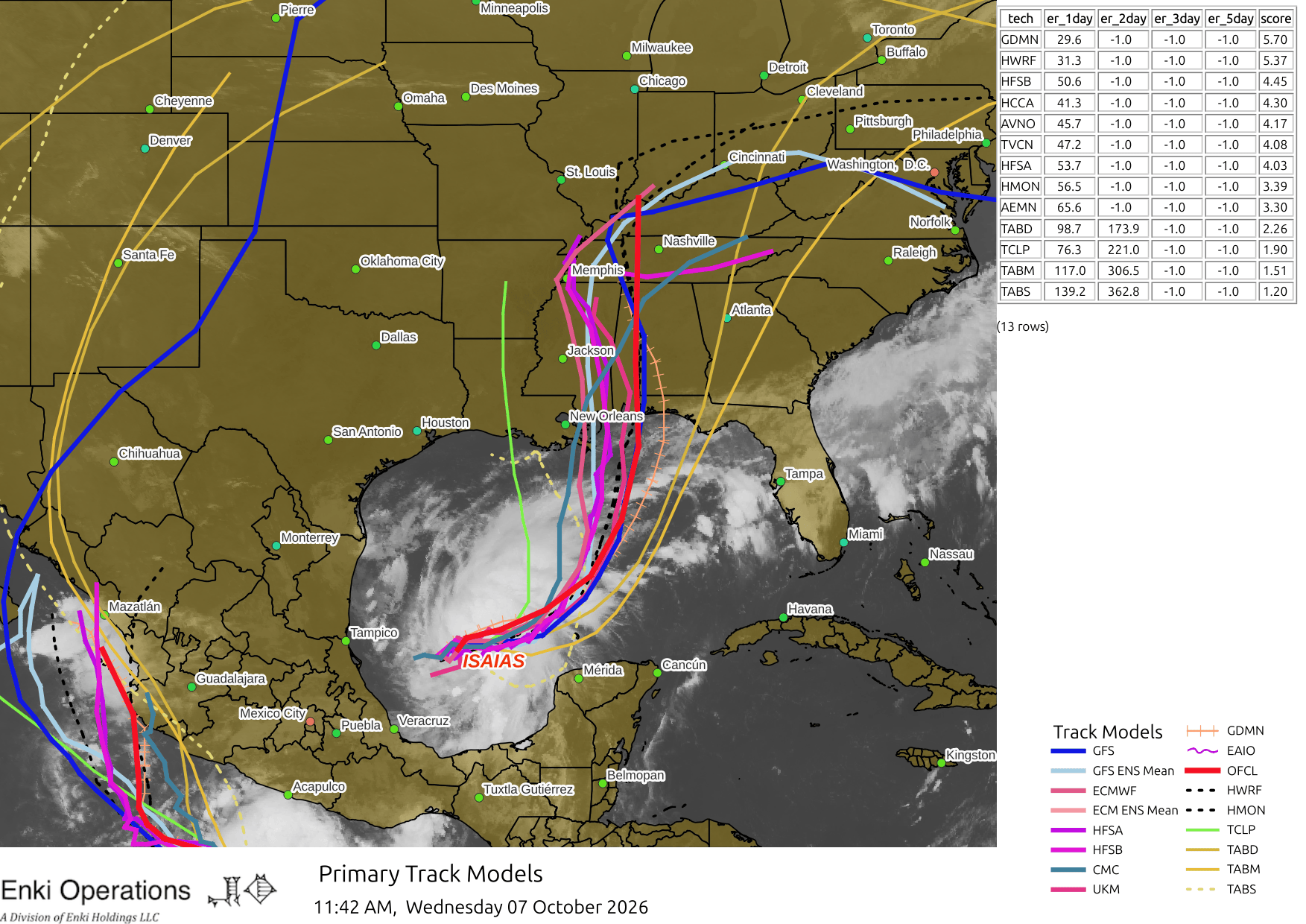
As a reminder, the green line (TCLP) is more of a reference line showing how storms located where Isaias is moved historically. The purple/blue lines are the modern dynamical models, the orange “railroad track” is the Google “Deep Mind” model, the two on the right are trajectory models that are using steering currents in the upper and middle atmosphere.
Impact estimate pretty much the same as this morning (link).
The lines off to the left are from Tropical Depresion Twenty-East, and as a side note Hurricane Rachel, which looks to do a hard right turn and maybe hit the San Diego area with rain and winds (although not as a hurricane or tropical system):

So much for the quiet season …