

Three hurricanes and a tropical storm impacting/threatening land today, and the US Northeast is facing its first nor’easter of the season.

Starting with the hurricanes/typhoons, and starting with the Atlantic, Tropical Storm Gonzalo is bringing tropical storm conditions to the Cape Verde islands and coast of Africa this morning. Here are NHC’s Key messages regarding Tropical Storm Gonzalo (en Español: Mensajes Claves) and my TAOS(tm)/TC model hazard swath:
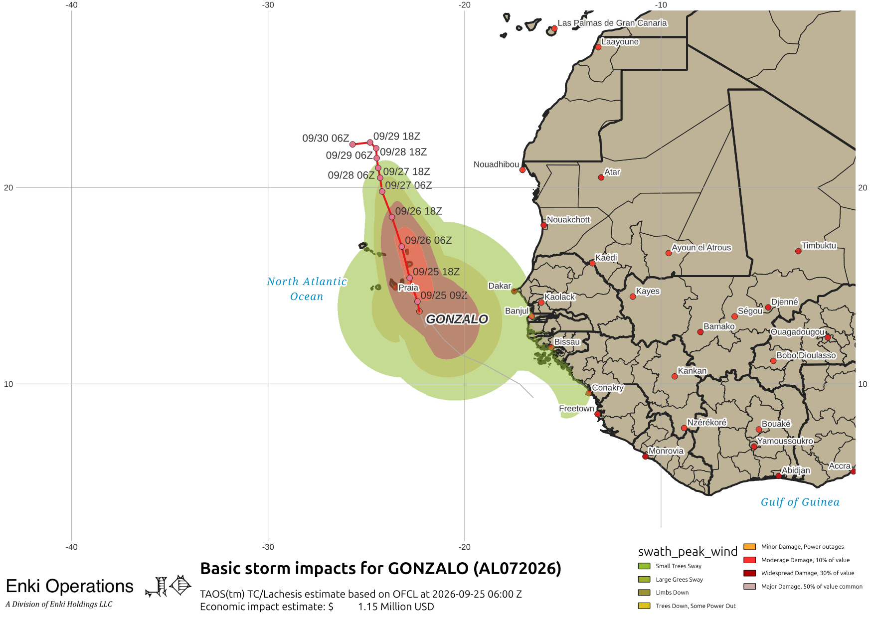
Not likely to cause a lot of damage, as is usually the case with weaker system flash flooding is the biggest risk.
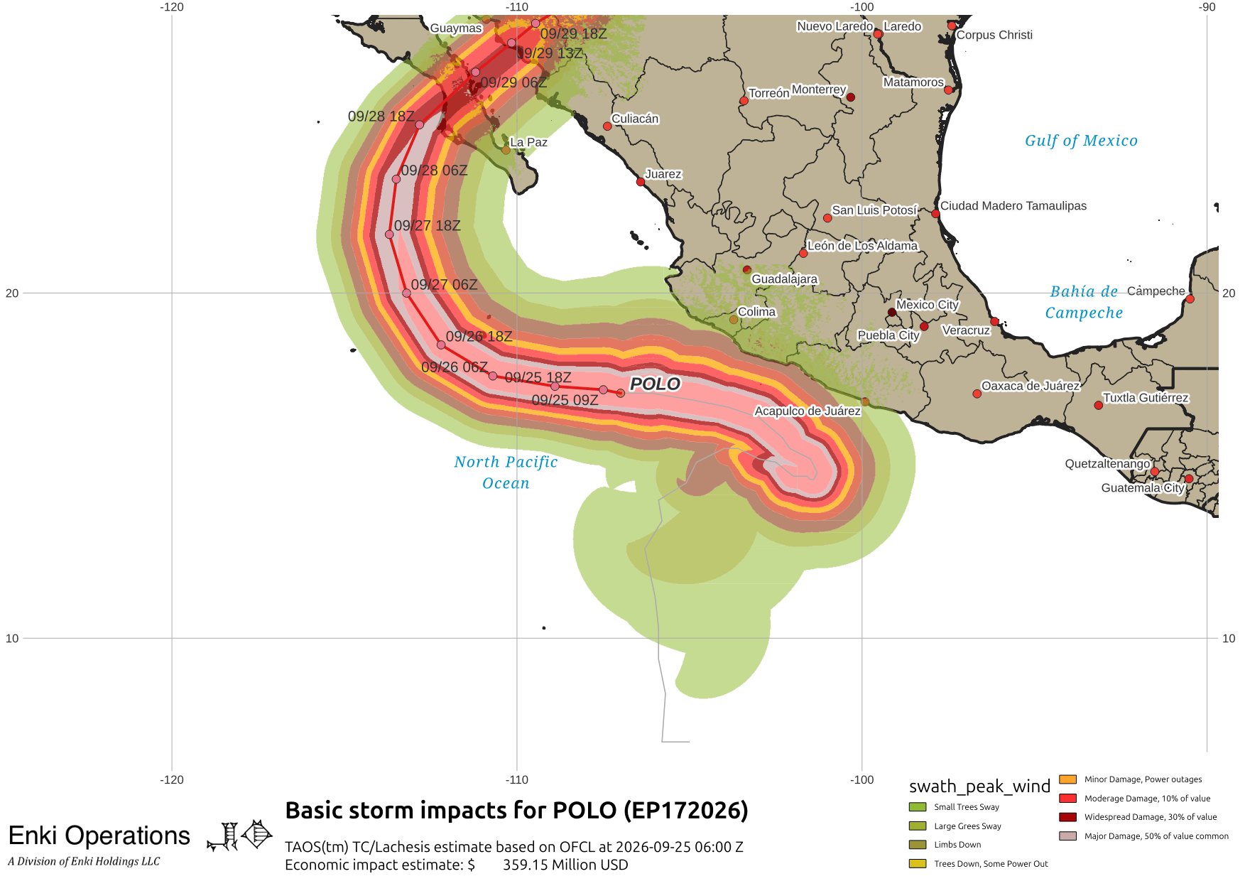
Next up is a serious threat, Hurricane Polo, which has been a major hurricane for several days and is likely to remain so until landfall in Baja. Key messages regarding Hurricane Polo (en Español: Mensajes Claves).
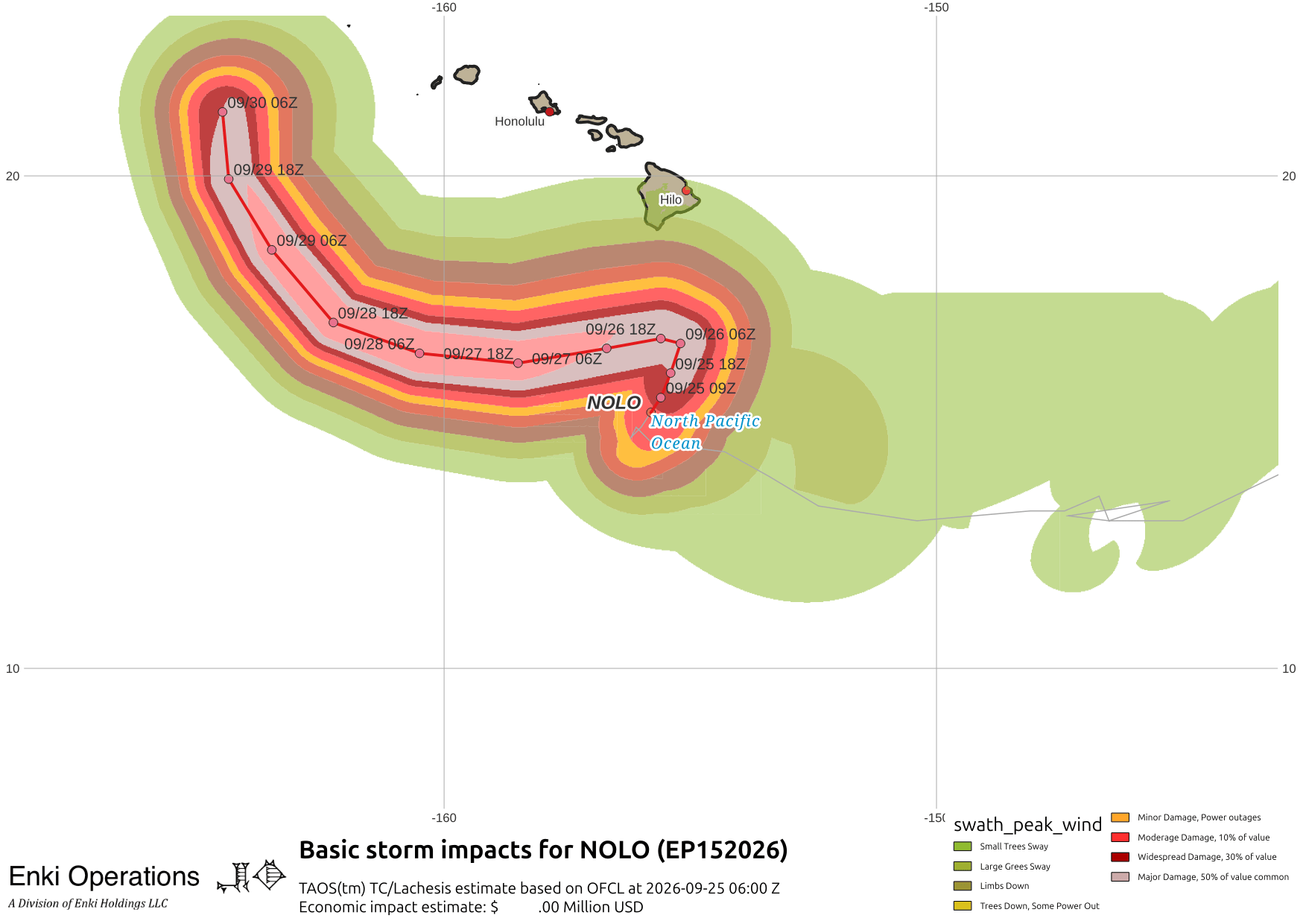
Continuing west, Nolo is gaining strength south of Hawai’i. Key messages regarding Hurricane Nolo (en Español: Mensajes Claves). Hurricane warnings are up for the Big Island, and tropical storm warnings for the central islands:

Right now the worst threat is likely to be flooding and hurricane force winds along the ridge lines of the Big Island, but a northward wobble could make things a lot worse.
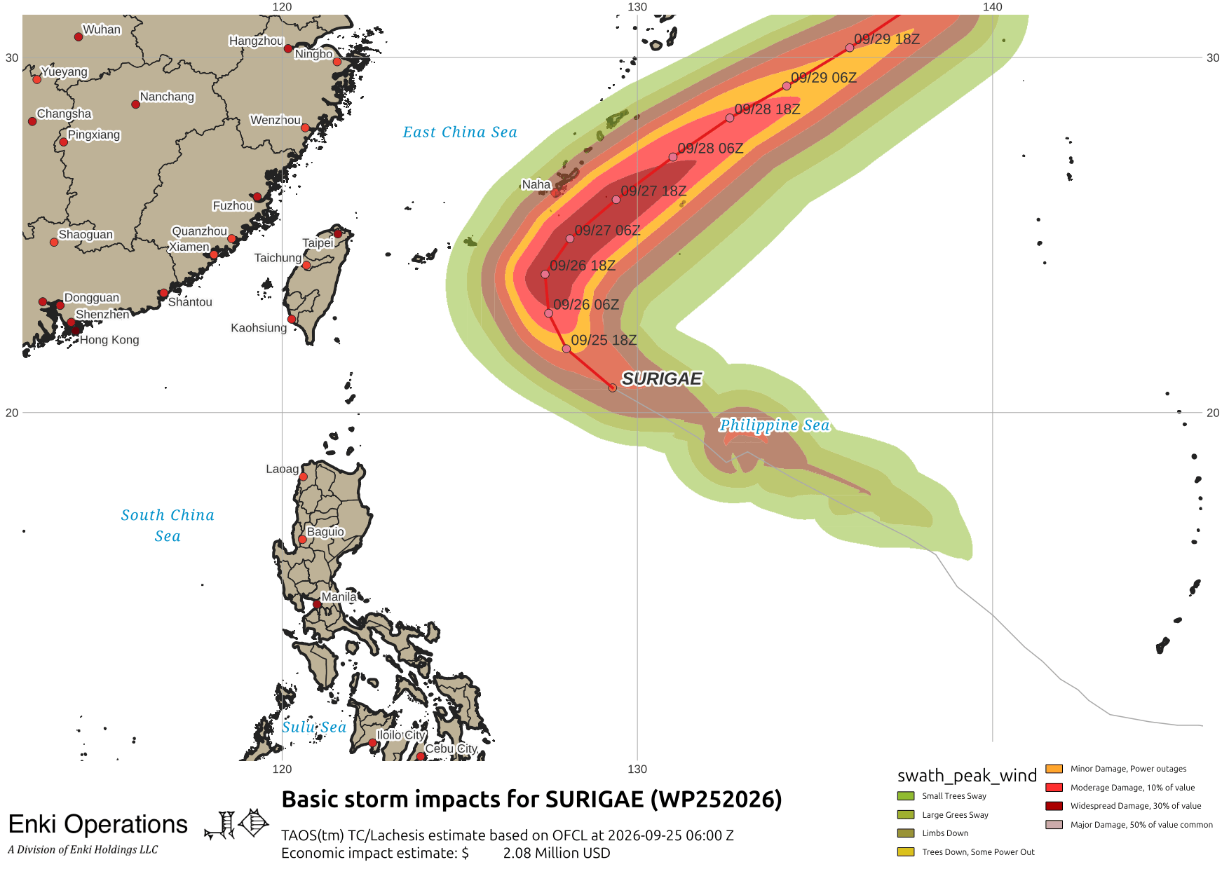
Finally from a tropical standpoint, Surigae will be looping just offshore from the Ryuku Islands, including Okinawa and the US Bases there. If this track holds impacts should be light, but a delay in the turn or wobble can make things worse so prepare as directed.
Finally, in non-tropical news, the first nor’easter of this fall/winter is spooling up off the North Carolina coast. Here is this morning’s “cloud microphysics” analysis, showing the storm center and thick cold clouds with ice particles forming. The cloud physics product are important for figuring out what is going on inside storms like this one:

The low is expected to do a bit of a loop just off of New Jersey before moving north towards Markland and Vinland (the proper historical names for Nova Scotia and Newfoundland 😛 …). Hopefully this animation doesn’t cause either WordPress or your browser to choke …
Here are WPC’s key messages for the storm:

Damage is likely to be on the light side (unless it’s your house that’s unlucky), but the disruptions are likely to have economic impacts in the millions.
The insane hype over El Nino continues. I ranted on that recently (link) in case you missed it. While we don’t want too much of a good thing, the typically higher rain totals in an El Nino may help break the droughts across much of the south, and refill many dangerously low reservoirs out West, so as the saying goes it’s an ill wind indeed that blows no good, and the positives could easily outweigh the negatives (but that’s not good scary headlines).
If you appreciate the blog, the best way to get it is to subscribe to the emails. You can subscribe and also donate to keep it going at this link. Many thanks to those who have contributed to the blog!
You can also follow us on Musk’s Madness X/Twitter (@EnkiResearch), Telegram, BlueSky, or even Facebook if that is your preferred social media mudpit. But be aware that social media algorithms don’t show you posts in chronological order, “upgrade” sensationalist material, and “downgrade” posts that have outside links in order to keep you on their platform, so it’s not a great way to get weather warnings.