

The blob fades, but the scary hype about the El Niño continues.
First, quick tropical overview. The Atlantic Blob is now only 10% and fading …
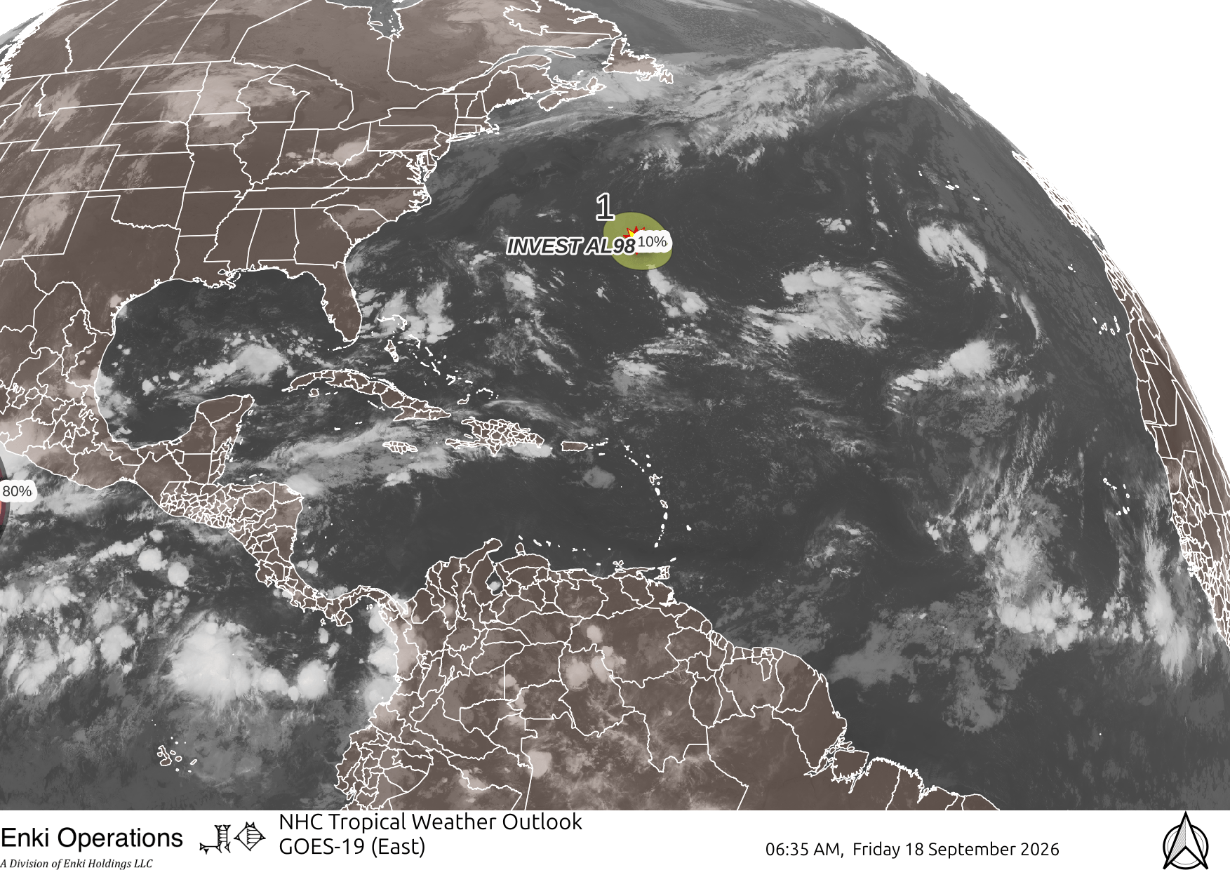
East Pacific is very blobby. No threats to land, but disturbance #3 needs watching since it may develop close to Mexico although steering to the north might bring it in to Baja, so if it develops will be worth watching.

West Pacific has Typhoon Dujuan, which looks to curve just offshore from Tokyo in two days, probably close enough for some impacts so expect disruptions if not major damage.

Lots of hype about the record El Niño index values and high temperatures in the West Pacific. As a reminder, the ENSO (El Niño-Southern Oscillation) is a normal climate cycle that goes through three phases, each lasting about a year to year and a half. This cycle is getting a lot of hype because the index, which is just the temperature anomaly (how much the average temperature is above/below normal for a particular area of the Pacific) is at record highs, as you can see in this graph:

It’s forecast to go even higher, and the odds of a “strong” El Niño event this winter are very high:

However, that said, THE MOST IMPORTANT THING TO KEEP IN MIND IS THAT THE STRENGTH OF THE INDEX IS NOT WELL CORRELATED WITH THE IMPACTS!
In other words, just because the index is at a record high doesn’t necessarily mean that impacts will set records. As with most weather and climate events, it’s complicated. There are interactions with other cycles, and sometimes a particular variable like ocean temperatures can get so high it messes with some other variable, and the relationships fall apart. So while thre will be impacts, there are always impacts from weather cycles, so all the hype may well turn out to be just that: hype.
For example, people love to talk about how warm oceans provide more fuel for hurricanes. Absolutely true. But that can trigger a warmer, more stable air column that interferes with hurricane formation. It’s complicated.
What we do know is that El Niño causes weather changes across the world. Here’s a brief summary of typical temperature and precipitation:

For the US, here’s what we are looking at based on the latest model runs – you’ll have to “click to embiggen” to see the details, but basically for the next year for Coastal GA/SC (the Metroplex) we’re looking at near normal temperatures over the winter months, above normal spring and summer next year. At least the precipitation looks at or above normal throughout, typically El Nino years are wet and we may get too much of a good thing:


If you appreciate the blog, the best way to get it is to subscribe to the emails. You can subscribe and also donate to keep it going at this link. Many thanks to those who have contributed to the blog!
You can also follow us on Musk’s Madness X/Twitter (@EnkiResearch), Telegram, BlueSky, or even Facebook if that is your preferred social media mudpit. But be aware that social media algorithms don’t show you posts in chronological order, “upgrade” sensationalist material, and “downgrade” posts that have outside links in order to keep you on their platform, so it’s not a great way to get weather warnings. Have had problems with links to/from Facebook in particular lately.