

Another super-busy week, as both Europe and the Middle East are on geopolitical fire. For the most part has decided to give us a break, but there are a couple of problem areas.

In the West Pacific, despite only brushing Japan Typhoon Dujuan killed at least four in Japan, with six still missing from floods and landslides. This should be a warning for Mexico (and everyone in general) that even near misses can, in the right circumstances, prove deadly.
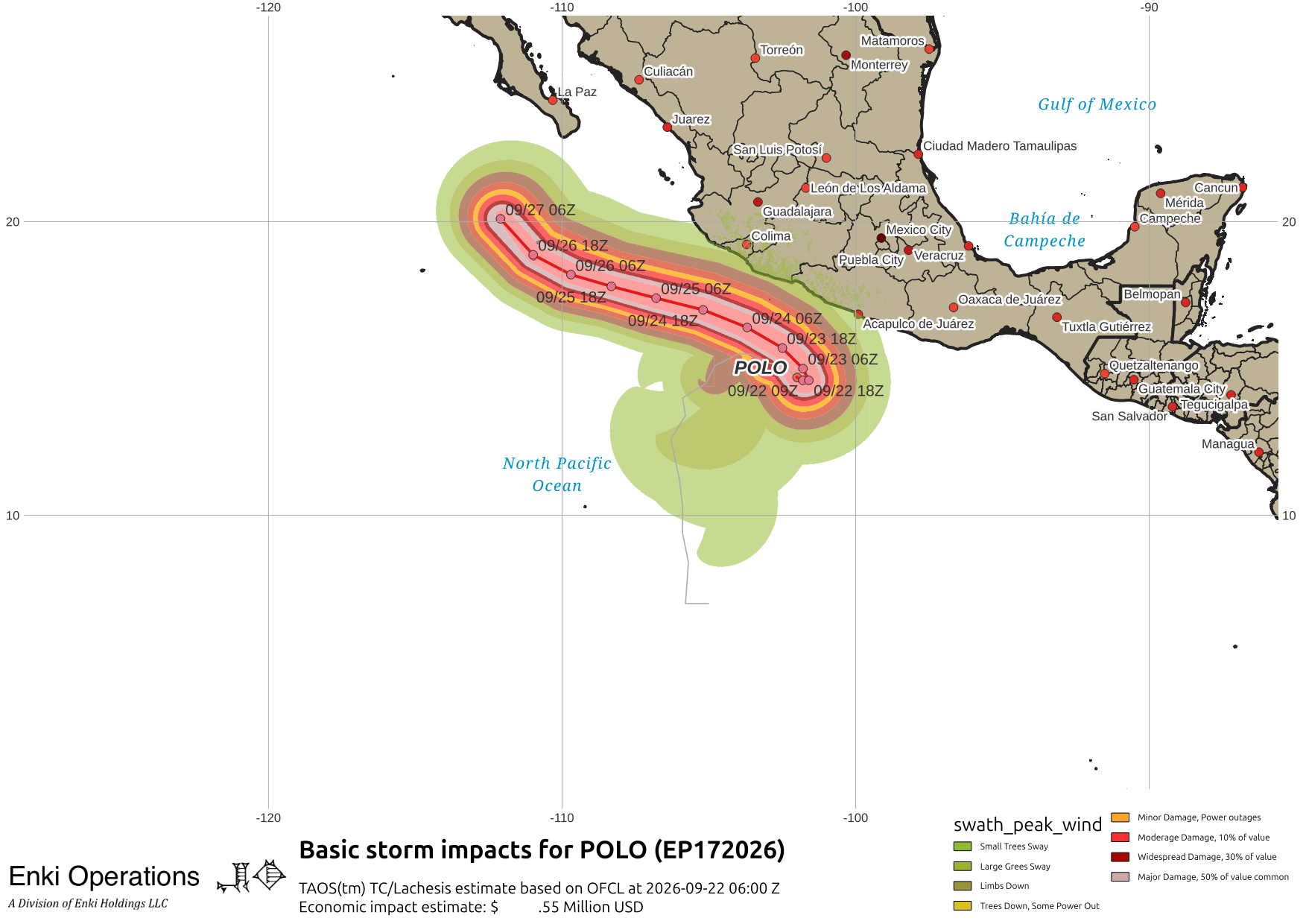
Looking at Hurricane Polo, here are NHC’s Key messages regarding Hurricane Polo (en Español: Mensajes Claves). It’s currently stalled off the Pacific Coast of Mexico, but should start moving parallel to the coast today. High winds should stay offshore, but heavy rains will hit the coast along with the risk of flash floods and landslides.
The Atlantic remains pretty quiet. Tropical Storm Fay continues to be an annoyance only to fish and fish related activities, there’s a yellow blob of doom off the coast of Africa that NHC advises “Interests in the Cabo Verde Islands should monitor the progress of this system as gusty winds and areas of heavy rain are possible there by the end of the week.“

For those of us on this side of the Atlantic, it shouldn’t be a factor for a while, if ever. There is an area just offshore the GA/SC coast (that blessed region containing the sacred precincts of the Frogmore Metroplex) that is generating showers and thunderstorms that are again this morning moving towards the coast. On the GOES lightning mapper you can see the offshore activity just starting to build, as well as the approaching cold front now across the GA/TN/NC border …


The insane hype over El Nino continues. I ranted on that recently (link) in case you missed it. While we don’t want too much of a good thing, the typically higher rain totals in an El Nino may help break the droughts across much of the south, and refill many dangerously low reservoirs out West, so as the saying goes it’s an ill wind indeed that blows no good, and the positives could easily outweigh the negatives (but that’s not good scary headlines).
If you appreciate the blog, the best way to get it is to subscribe to the emails. You can subscribe and also donate to keep it going at this link. Many thanks to those who have contributed to the blog!
You can also follow us on Musk’s Madness X/Twitter (@EnkiResearch), Telegram, BlueSky, or even Facebook if that is your preferred social media mudpit. But be aware that social media algorithms don’t show you posts in chronological order, “upgrade” sensationalist material, and “downgrade” posts that have outside links in order to keep you on their platform, so it’s not a great way to get weather warnings.
Where are we in the ground saturation drought index?
Locally it’s improving, still some D2 (severe) in Beaufort and Jasper, and most of Effingham is still Moderate, but Bulloch has some areas that are technically out of drought (14.6% of the county) …