

While the Atlantic remains quiet (yeah, yeah, orange blob and Fay, they aren’t threats), the Pacific continues to spawn dangerous systems. Tropical Depresson 15E is expected to rapidly redevelop and brush the big island of Hawai’i. Here are the Key messages regarding Tropical Depression Fifteen-E (en Español: Mensajes Claves) from CPHC. It’s a potentially dangerous situation that those in the Islands need to prepare for. Here’s the impact forecast using my TAOS(tm)/TC model:
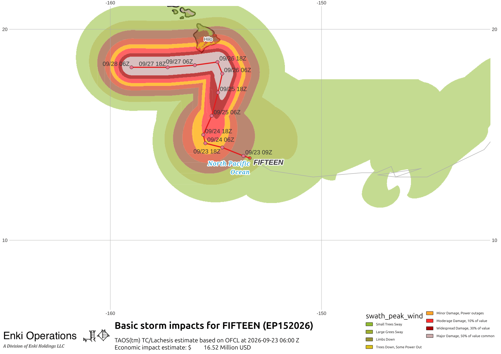
It won’t take much of a wobble to turn this into a direct hit. The forecast intensity envelope shows rapid development. CPHC (the black line) is more enthusiastic than the models, in part because of the proximity to land. Watches/Warnings are likely to go up this morning:

Off of Mexico’s Pacific coast, Hurricane Polo is a powerful major hurricane just offshore from Acapulco, here as the sun rises over the West Pacific …

The worse of the winds should stay offshore, but rain bands will cause flash floods and landslides, and waves will be dangerous.

In 5-6 days Polo may be a direct threat to Baja, longer range track models shows turns or loops … so stay tuned.
