

Busy tropical map this morning, with three major events developing.

Hurricane Polo remans a powerful storm, just off the coast of Mexico. Here are links to NHC’s Key messages regarding Hurricane Polo (en Español: Mensajes Claves). As warned yesterday, the forecast is looking more like a landfall in Baja. Here is the impact swath using my TAOS(tm)/TC model:
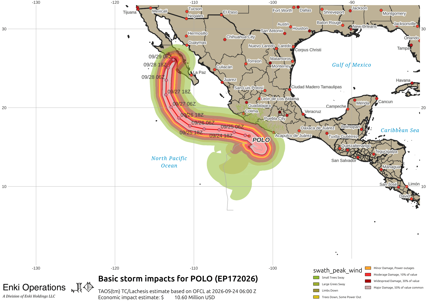
Tracking and intensity estimates keep Polo a powerful storm as it curves offshore then back towards Baja:


Farther west, the forecasts show Tropical Storm Nolo to continue to rapidly intensify and reach major hurricane strength as it curves just south of the Big Island. There is a hurricane watch up for the island of Hawai’i, here are CPHC’s Key messages regarding Tropical Storm Nolo (en Español: Mensajes Claves), and my impact map based on their forecast and my TAOS(tm)/TC model:
CPHC’s intensity forecast is at the upper end of the guidance, which is typical in these situations as they don’t want to be on the low side. Here’s the tracking and intensity forecast graphs:


With this forecast the biggest threat (or, if you are a PROFESSIONAL surfer, opportunity) are waves, wind at higher elevations and ridge lines, and rain. The rain is always a problem on a mountainous island for flash flooding and landslides.
Tropical Storm Surigae should become a typhoon, and is threatening Okinawa and the Ryuku Islands …
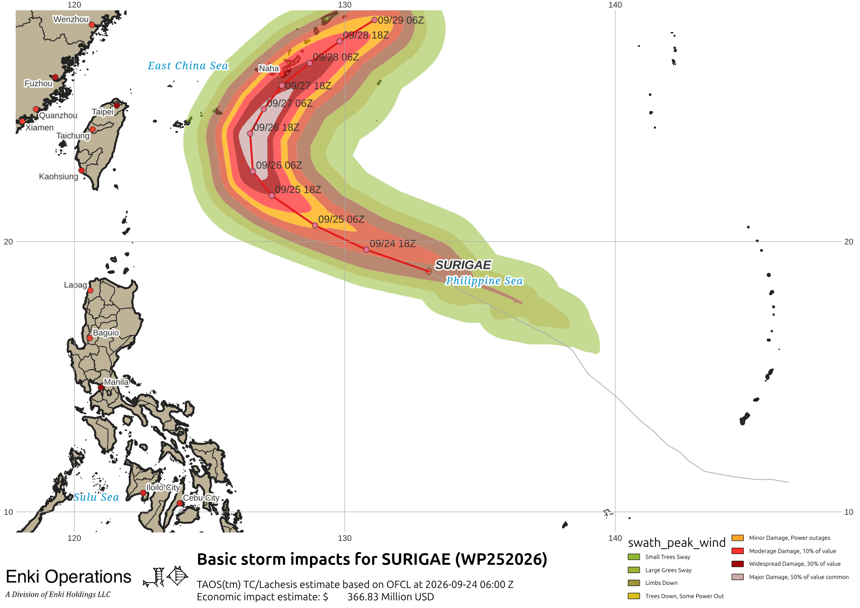
Kadena Air Base should expect a brush-by early next week.
Continuing our global tour, a tropical depression is making landfall in India this morning …
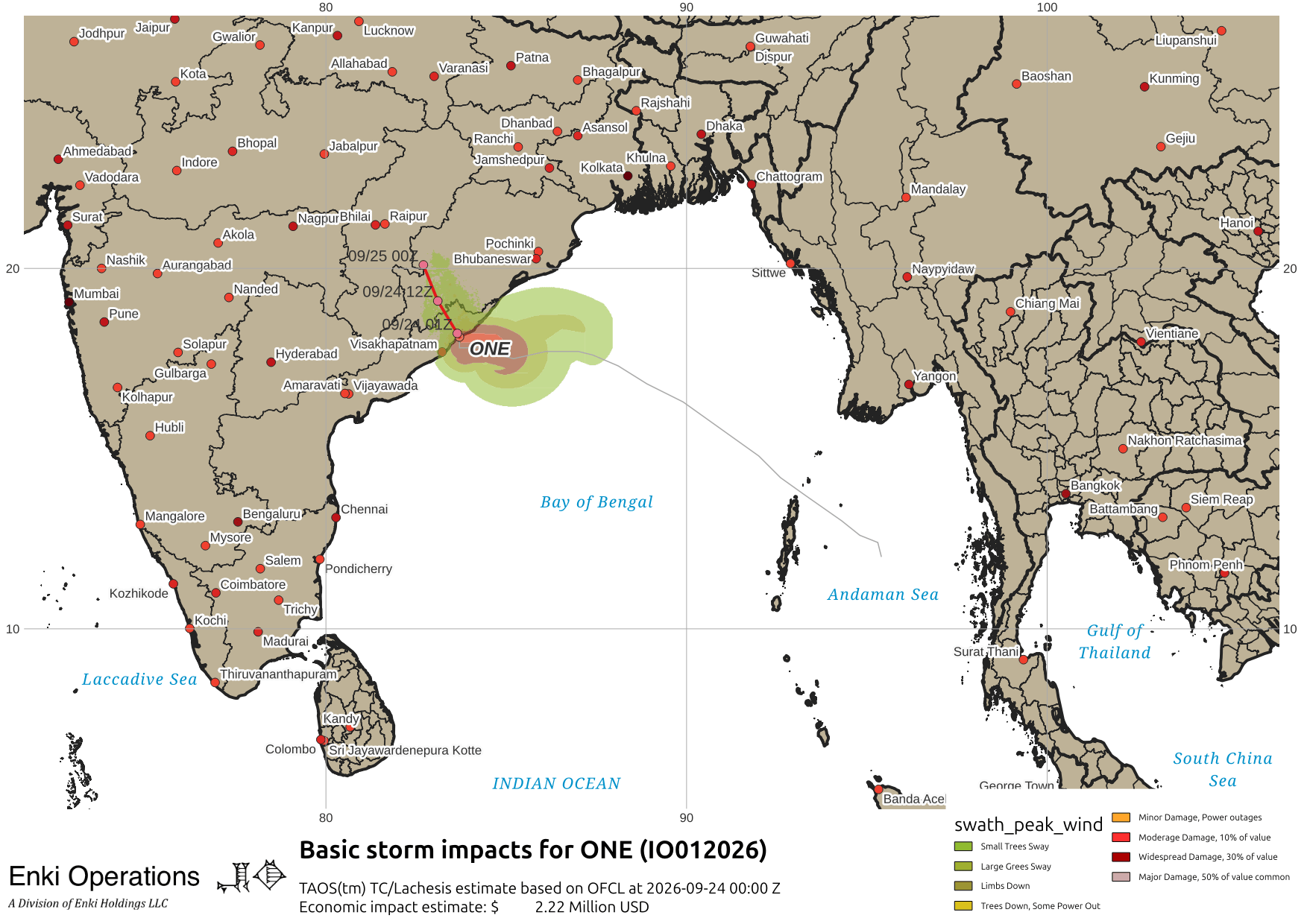
Impacts should be somewhat minor, but there are about half a million people in the hazard zone, and the limited infrastructure is always a risk of bad things happening.
Finally, Atlantic storms are of the fish and fish related interests variety (Fay), or weak systems (AL90, near the Canary Islands) …

If you appreciate the blog, the best way to get it is to subscribe to the emails. You can subscribe and also donate to keep it going at this link. Many thanks to those who have contributed to the blog!
You can also follow us on Musk’s Madness X/Twitter (@EnkiResearch), Telegram, BlueSky, or even Facebook if that is your preferred social media mudpit. But be aware that social media algorithms don’t show you posts in chronological order, “upgrade” sensationalist material, and “downgrade” posts that have outside links in order to keep you on their platform, so it’s not a great way to get weather warnings.