

Note: the NHC web page was broken as of 6:30am this morning, some of it seems working again as of 7am but it’s still wonky.
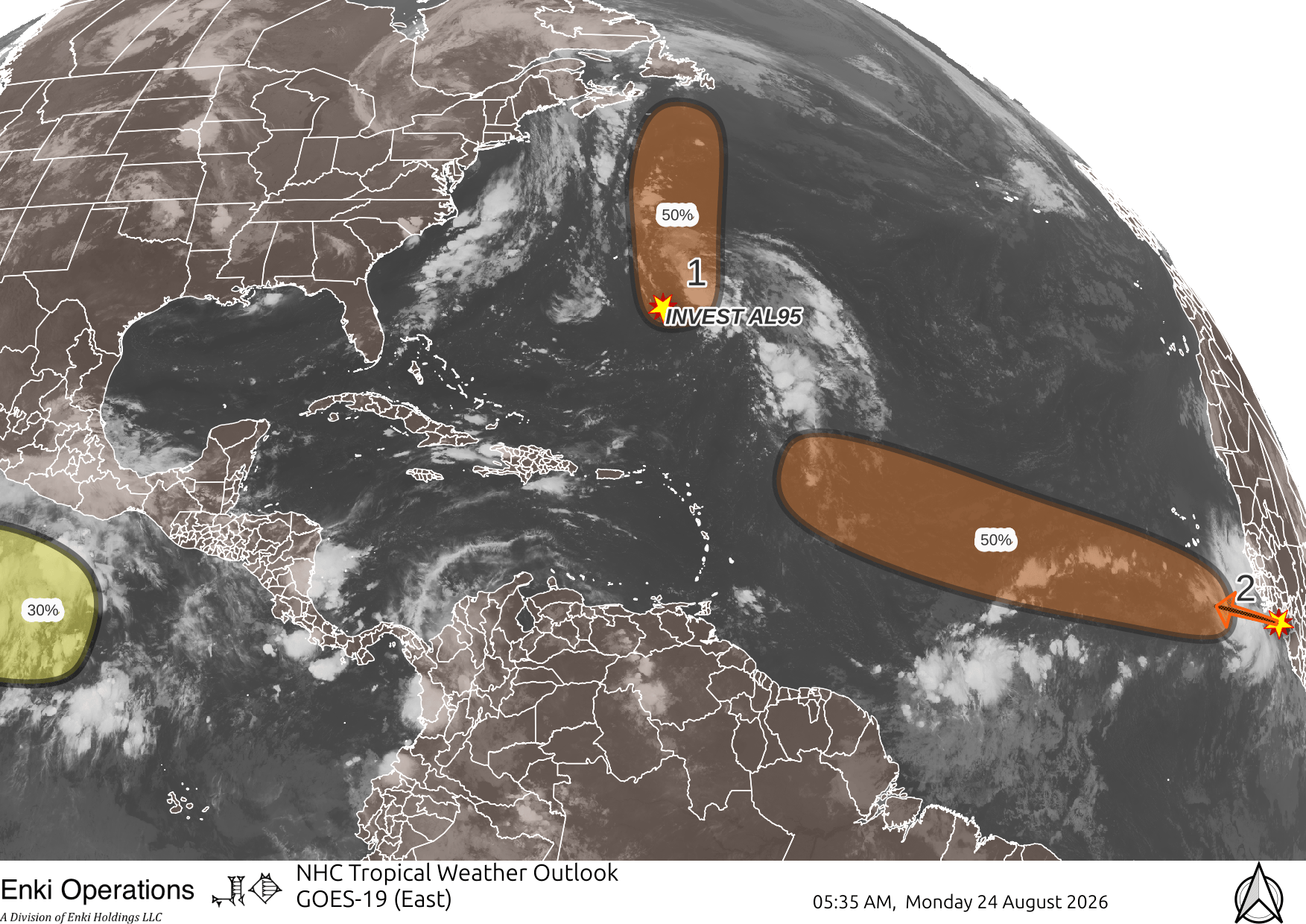
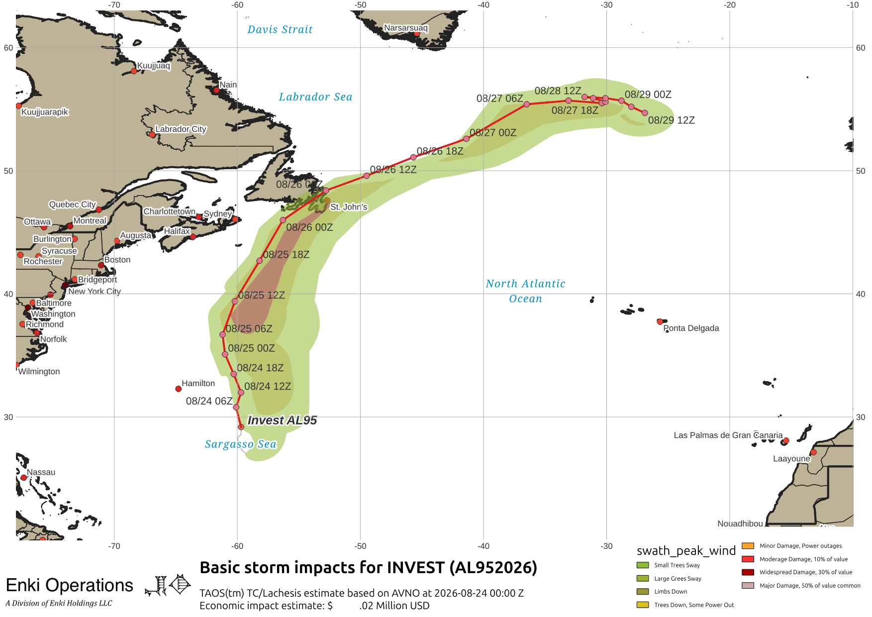
Looking at Disturbance #1 on the NHC Tropical Weather Outlook (the above Enki graphic is confirmed up-to-date, the raw data feeds seem ok), which has the temporary INVEST id of AL95, it is getting better organized and might become a depression, but its long term prospects or threat to land is minimal. There is a fair chance wind, rain, and waves might brush Vinland … here’s the forecast imact map using the GFS model:
Disturbance #2 is the strong wave coming off of Africa that has the doomscrollers excited. It isn’t an INVEST with discrete model tracking yet, so all those “track” maps floating aound out there are somewhat misleading if you don’t know what you’re looking at – and the clickbaiters are definitely misusing them to gin up traffic. What the global models are showing in about six days is a depression or tropical storm moving across the Atlantic. GFS (left) is more enthusiastic than the European model (right) … we’ll know more in a few days so still nothing to get terribly excited about.


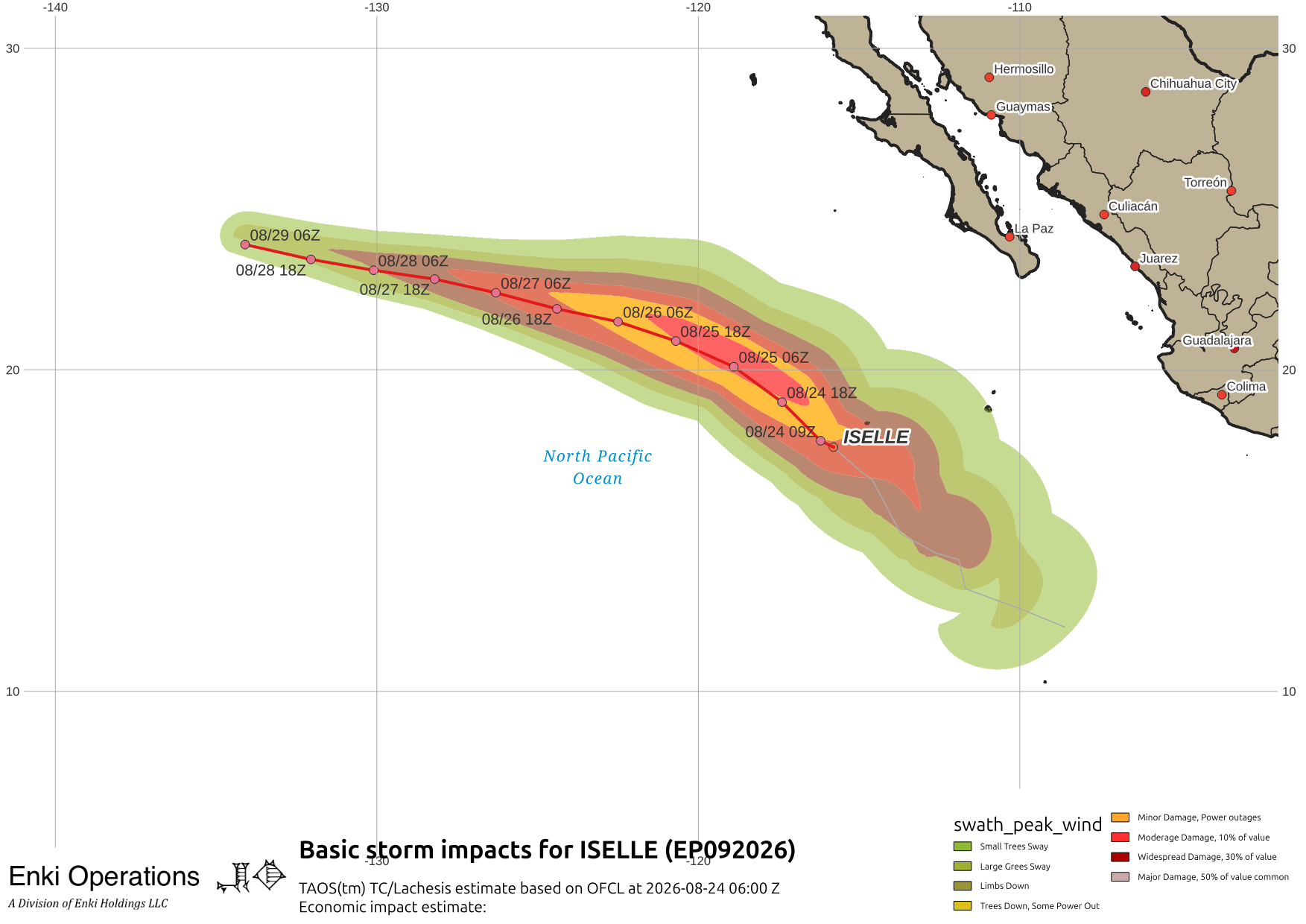
Moving east, Iselle has formed well off of the coast of Mexico, it’s a fish storm and likely to remain so.
Tropical Storm Moke is fading out south of Hawai’i but heavy rains still over the Big Island…

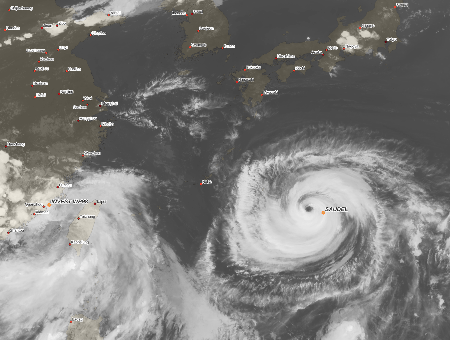
In the West Pacific, Saudel flared this morning (evening in Japan) and is an impressive storm on IR as it tracks towards Okinawa …
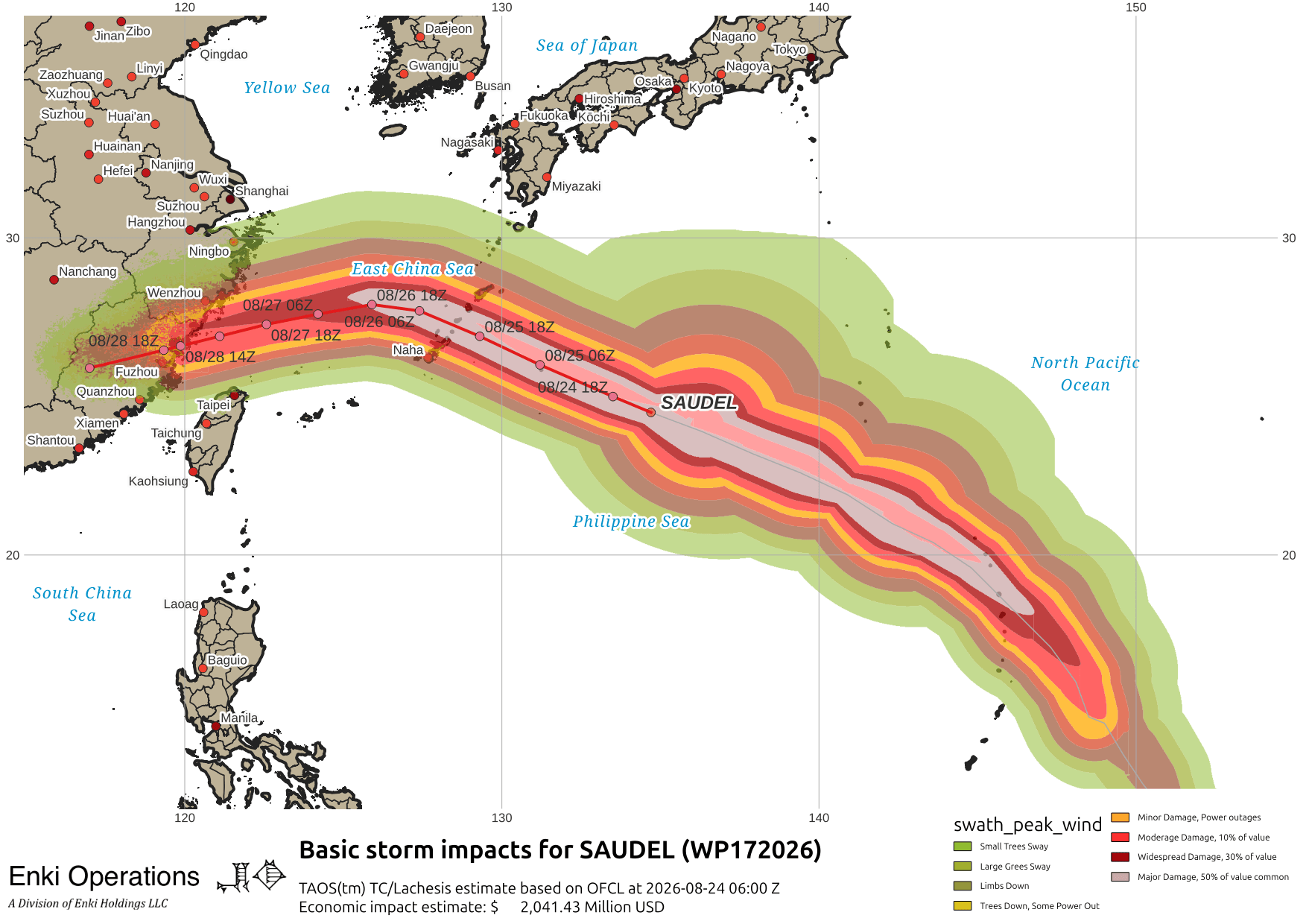
Here’s the potential impact swath from my TAOS(tm) model, based on the Joint Typhoon Warning Center forecast:
It’s still a complex forecast situation with FOUR systems interacting over the Philippine Sea this morning:
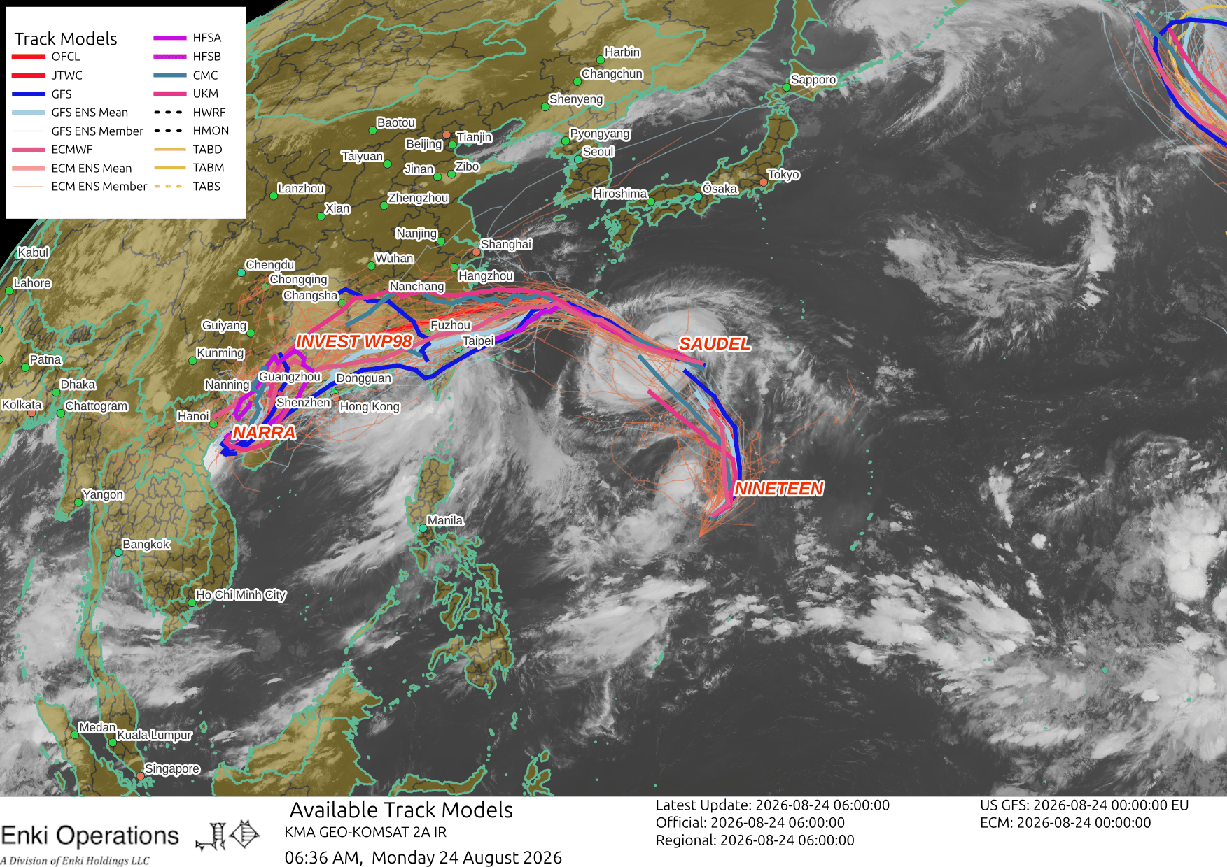
But it is certain Okinawa and the Ryuku Islands will get Typhoon conditions out of this thing so pay attention to local emergency managment and take proper precautions.
If you appreciate the blog, the best way to get it is to subscribe to the emails. You can subscribe and also donate to keep it going at this link. Many thanks to those who have contributed to keep the blog going!
You can also follow us on Musk’s Madhouse X/Twitter (@EnkiResearch), Telegram, BlueSky, or even Fakebook if that is your preferred social media quagmire. But be aware that social media algorithms don’t like to show you posts in chronological order. They “upgrade” sensationalist material, and “downgrade” posts that have outside links in order to keep you on their platform, so it’s not a great way to get weather warnings or news (or anything other than a variety of psychiatric symptoms for that matter).