
We’re returned to a more normal tropics this weekend, with all of the basins except the Indian Ocean showing activity, but with threats only to Japan/China and Hawai’i at the moment.

Starting with a quick look at the Atlantic:

The disturbance labeled “2” on the NHC TWO (mid-atlantic) is now being tracked as Invest AL95. Remember that until a system gets an invest ID, it doesn’t have dedicated model runs. All the slop you are seeing about the wave coming off of Africa using the “genesis” tracks are just that: slop. So even though that wave is expected to spin up (and has a much higher chance than AL95), it’s not over water and not orgainized enough for a distinct circulation center, so there are no model tracks yet, not in the sense you are used to seeing. That will start in the next day or so but until then, it’s just clickbait. But something is potentially going to develop, here’s the GFS run this morning showing a system out there in six days … but it’s too early to get excited about it.

With respecct to AL95, it isn’t expected to be a threat even if it does spin up, although it might brush Vinland (called Newfoundland by the occupying Canadian Government) with rain and gusty winds:

The other blob (#1, nearing Europe) should be gone by this evening.
For the US audience, Hawai’i is expected to get rain from Tropical Storm Moke. Here are CPHC’s Key messages regarding Tropical Storm Moke (en Español: Mensajes Claves), which are mostly warnings about rain, mudslides, etc.

You can see all of the convection is displaced well to the north of the center, but hopefully the tracking is far enough south of the Big Island to avoid more flooding.
Further west, Typhoon Saudel is tracking towards Okinawa …
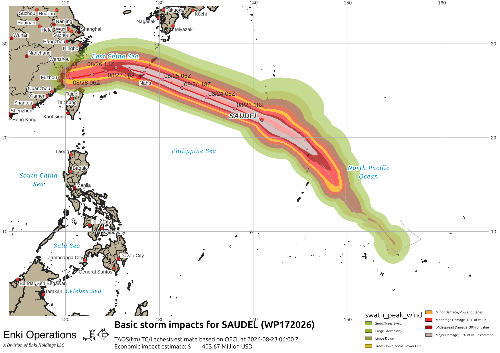
Kadena Air Base is at TCCOR4, on this track a direct hit looks increasingly likely, although the situation in the West Pacific is complicated, with Saudel, TD Nineteen, and Narra all interacting in weird ways with a frontal boundary thrown in to make it “interesting” … will be watching over the next couple of days to see how it develops.

If you appreciate the blog, the best way to get it is to subscribe to the emails. You can subscribe and also donate to keep it going at this link. Many thanks to those who have contributed to keep the blog going!
You can also follow us on Musk’s Madhouse X/Twitter (@EnkiResearch), Telegram, BlueSky, or even Fakebook if that is your preferred social media quagmire. But be aware that social media algorithms don’t like to show you posts in chronological order. They “upgrade” sensationalist material, and “downgrade” posts that have outside links in order to keep you on their platform, so it’s not a great way to get weather warnings or news (or anything other than a variety of nervous twitches for that matter).