

Graphics generation has moved to a dedicated server and is updating automagically now …

TL;DR on the tropics is there is a new storm in the West Pacific that looks to be a factor over the next week. Lala remains a hurricane as it tracks through the Northwestern Hawaiian islands, as a new system is forming to the southeast. Atlantic is quiet. Here’s the details:

The Central Pacific Hurricane Center (CPHC) has warnings up for the Papahanaumokuakea Marine National Monument east of Maro Reef
to French Frigate Shoals. The basic setup that carried Lala over the Big Island applies to the invest area EP90. CPHC is advising residents of Hawaii to “monitor” the situation. Here’s the track models this morning …

Moving east, a new tropical storm has formed in the West Pacific and is headed towards the Mariana Islands as it tracks towards Japan. Here’s my TAOS(tm) impact model estimate using the Joint Typhoon Warning Center forecast track:
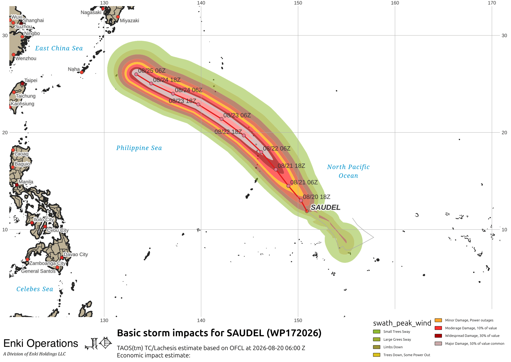
Tracking and intensity on days 4-5 have a lot of uncertainty due to potential interactions with the invest area WP 95 and a ridge pattern over Asia …

The Atlantic is utterly boring right now. High surface pressures and unfavorable upper air environment, nothing expected over the next week or so.


If you appreciate the blog, the best way to get it is to subscribe to the emails. You can subscribe and also donate to keep it going at this link. Many thanks to those who have contributed to keep the blog going!
You can also follow us on Musk’s Madhouse X/Twitter (@EnkiResearch), Telegram, BlueSky, or even Fakebook if that is your preferred social media quagmire. But be aware that social media algorithms don’t like to show you posts in chronological order. They “upgrade” sensationalist material, and “downgrade” posts that have outside links in order to keep you on their platform, so it’s not a great way to get weather warnings or news (or anything other than a variety of neurological symptoms for that matter).