

TL;DR: Tropical storm for Hawai’i looks more likely. Two of the disturbances in the Atlantic have been upgraded to Invest areas, only one matters. Tropical Storm Chan-Hom raining out over Japan.

The Atlantic Tropical Weather Outlook (TWO) this morning shows three disturbances. There are now track models for two of them, AL92 and AL93 (for a review of how tropical cyclone invest areas and names work, check out this post). AL93 is a fish storm, but AL92 has some potential to become a depression or tropical storm and impact the Leeward islands of the Caribbean. Here’s what the latest GFS run shows …
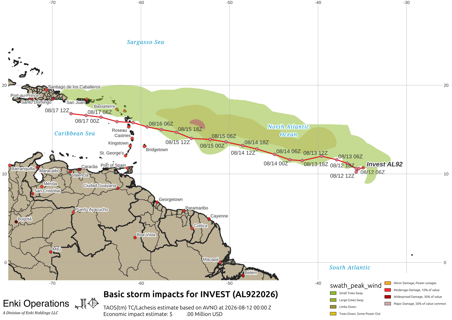
GFS is at the low end of the intensity estimates. Most of the dedicated models top out in the middle-tropical storm intensity in a couple of days, with the ever-enthusiastic HFS models jumping it up to that level this afternoon:
There are no “magic words” in the outlooks, so nobody needs to do anything at this point. That may change by tomorrow, when I expect the Caribbean will be asked to “monitor” the system for developments. In any event, conditions in the Caribbean are expected to remain hostile so this is unlikely to be a bad storm even if it spins up. There doesn’t seem much chance of it reaching the USVI or Puerto Rico as an organized system.
Invest area CP93 continues to brew in the Central Pacific. Most track models show it moving somewhere near or over Hawai’i:

The CPHC outlook Tropical Weather Outlook (en Español*) says to “closely monitor” because if trends continue, there will be watches and warnings this weekend. GFS shows it near hurricane force as it approaches the big island, here is my TAOS(tm) TC model impact estimate based on the GFS track:
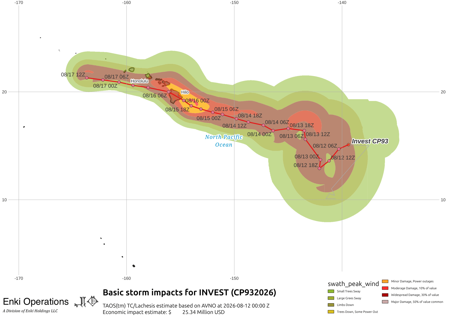
and other guidance is in that ball park, although the Canadian global model isn’t as enthusiastic:

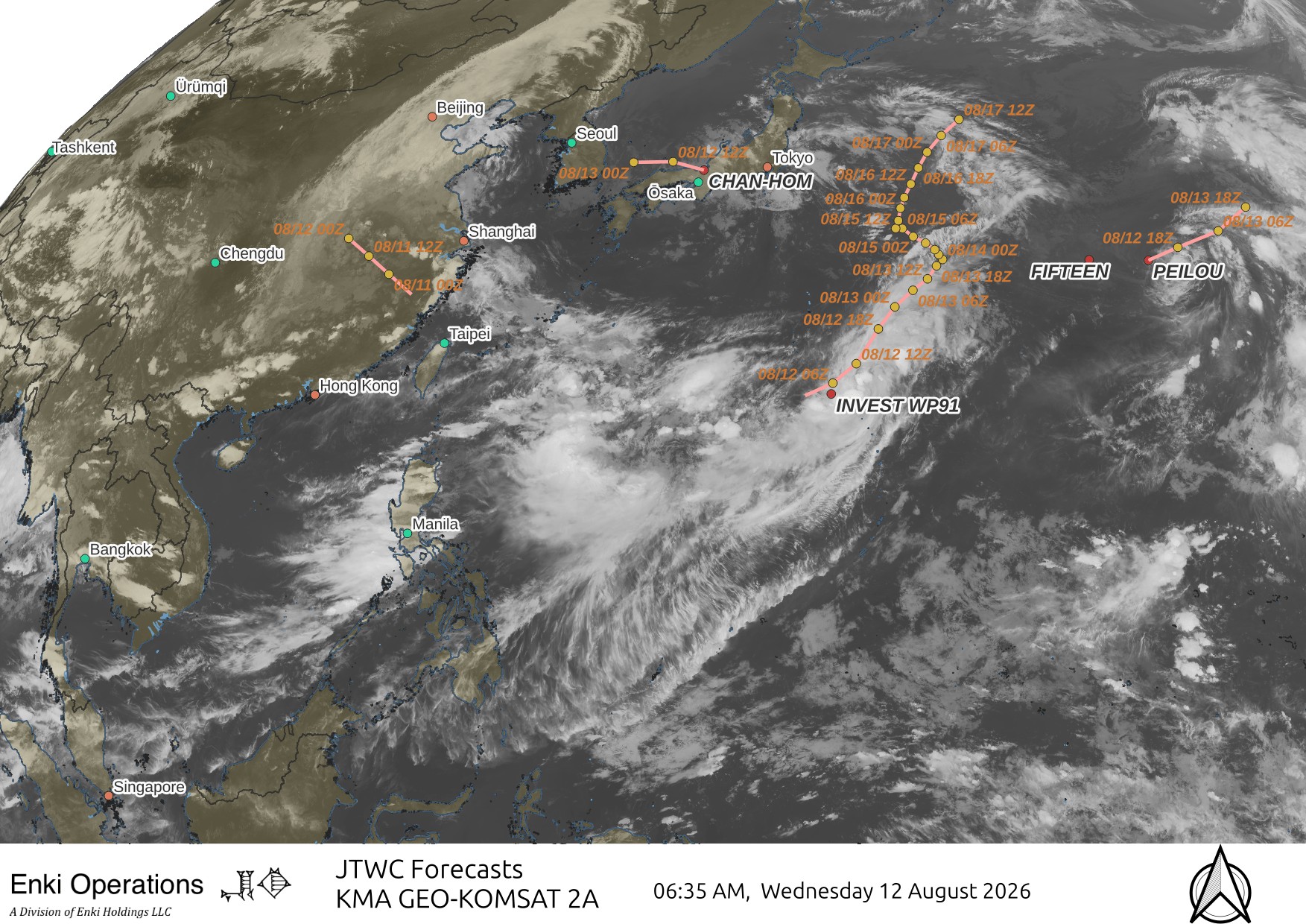
Tropical Storm Chan-Hom as expected was more of a disruption than anything, but caused power outages and unfortunately a few injuries in Japan as it weakens and treks west. Other WP storms are not threats.

If you appreciate the blog, the best way to get it is to subscribe to the emails. You can subscribe and also donate to keep it going at this link. Many thanks to those who have contributed to keep the blog going!
You can also follow us on Musk’s Madhouse X/Twitter (@EnkiResearch), Telegram, BlueSky, or even Fakebook if that is your preferred social media quagmire. But be aware that social media algorithms don’t like to show you posts in chronological order. They “upgrade” sensationalist material, and “downgrade” posts that have outside links in order to keep you on their platform, so it’s not a great way to get weather warnings or news (or anything other than a variety of gastrointestinal symptoms for that matter).