Tropical storm Fauso has broken up north of Hawai’i, Genevieve is weakening well away from land, Typhoon Dolphin is spinning up in the West Pacific and may be an issue in a few days.

Otherwise, mostly just trying to stay inside between the hours of 12:00 am and 11:59:59 pm because it’s just too hot and humid in the US Southeast. Here are the temperature curves for the last couple of days in midtown Savannah:
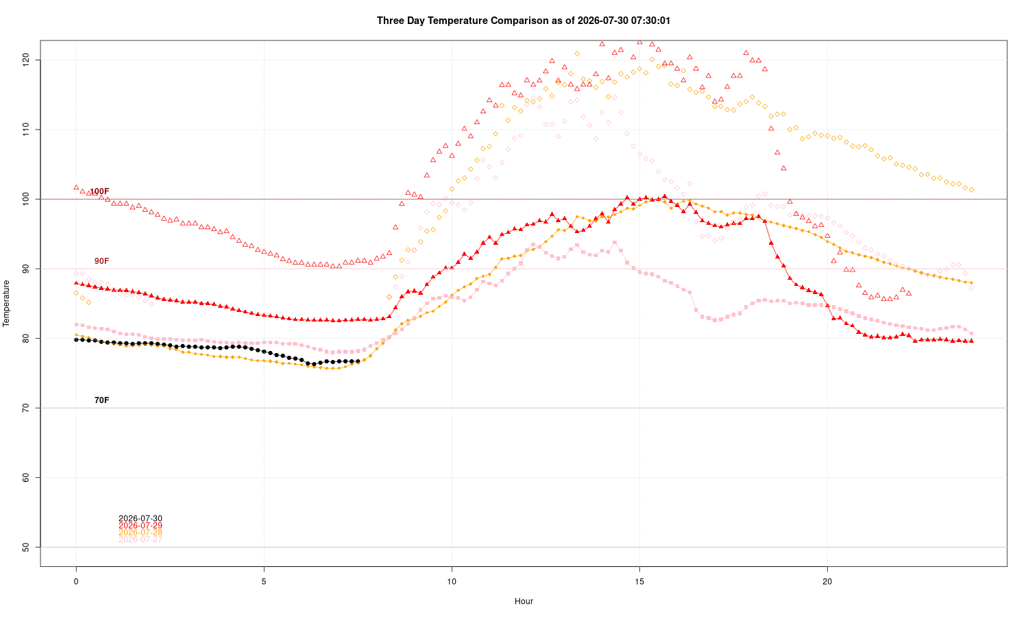
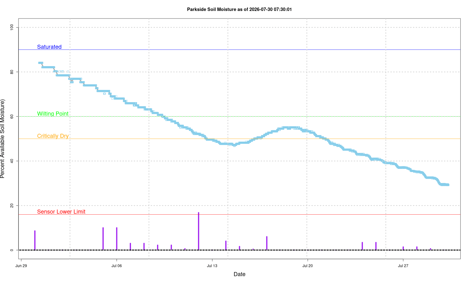
You can see the cool (well, less miserable) front passage overnight dropped the temperatures – notice the black line (this morning( is clearly well below yesterday’s horror in red. Rain has been spotty in the area, some got it, others like us near Daffin Park got skunked:

… so upper soil moisture levels continue to drop (purple lines are rain events, such as they were).
So how abnormal is this? The daytime temperatures are high, but far from record setting. Night time lows, on the other hand, have set records both in Savannah and Charleston. Five of the last ten nights exceeded the 60 year official records, at least here in midtown. But the killer (literally) is humidity: it’s running over 10% above average during the day, and that is what is causing the super-high heat stress values. An air temperature of 95 F with a humidity of 45% gives a heat index of 102. Same air temperature at 60% give 114. We’ve hit index values of over 125 F this week. The problem with the heat index is after a certain point it almost doesn’t matter. If the humidity is over 60% and air temperature much above 92 or so, your body just can’t sweat enough to cool off and it becomes increasingly dangerous.
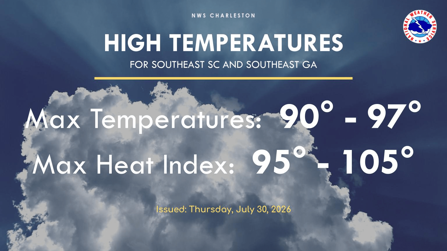
Forecast for today is a bit better, hard to call it “relief” … low values are on the beaches, heat index over 100 everywhere else.