

Quick update to add: NWS Charleston sent this note about the thunderstorms this morning:

Here’s their note:
Waterspouts: Forecast sounding output and elevated non-supercell
tornado parameters values over the nearshore and offshore waters
look to support a risk for waterspouts this morning. Satellite
and radar already suggest a few cloud lines are trying to
develop over the Atlantic which could become the focus for
waterspouts through late morning. A Marine Weather Statement
was issued to alert mariners to this possibility.
Typhoon Dolphin is making a bee-line to Okinawa, forecast to arrive at the end of this week …
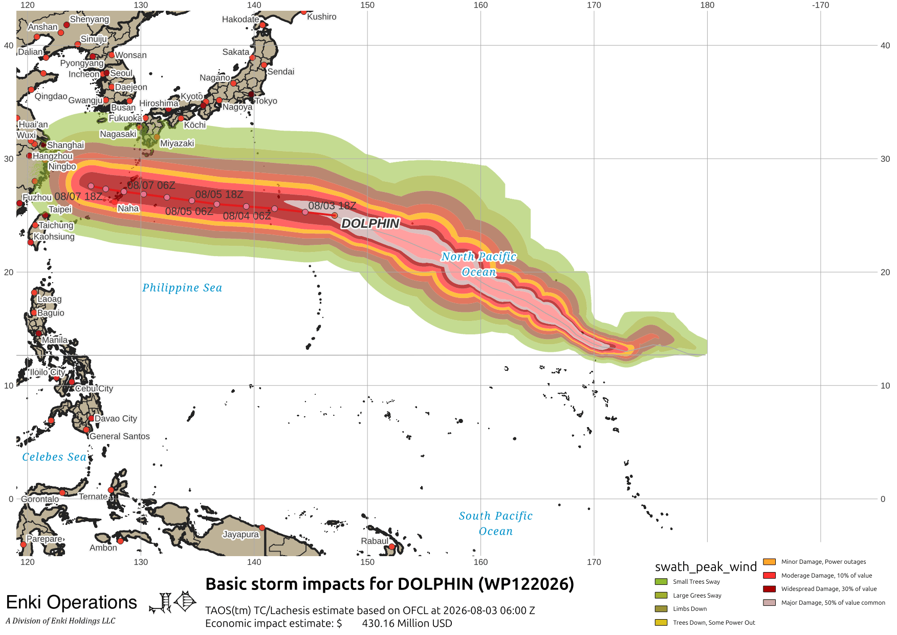
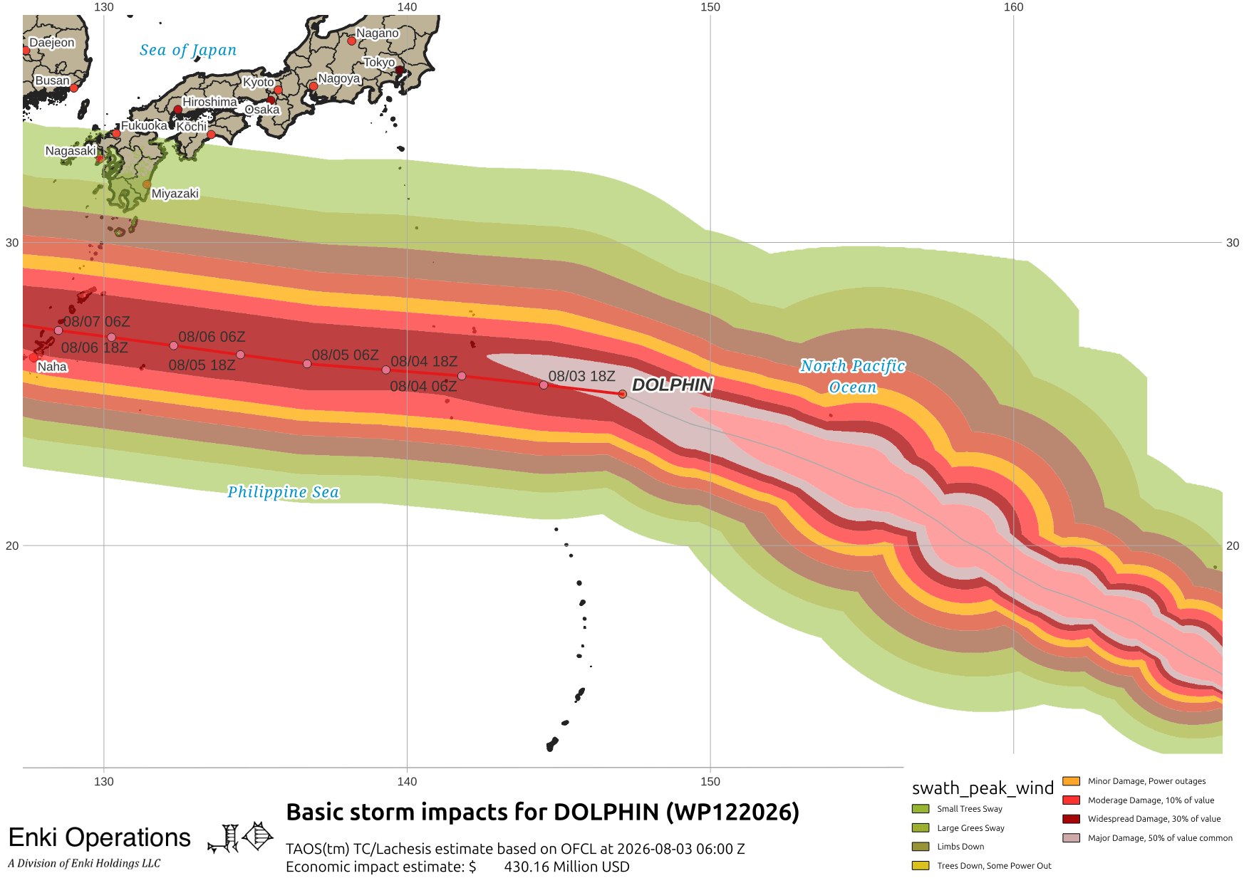
Dolphin an impressive storm on IR this morning as it tracks almost due west. Impacts could be significant, will have to be watching this later in the week.

Tracking is pretty tight. Here’s this morning’s model runs, notice also the system area over the northern Philippines that is dumping a lot of rain there, with severe flood advisories up for the capital region. JTWC is still calling it an INVEST, but PAGASA (the Philippines weather agency) is tracking it as tropical depression Luis.

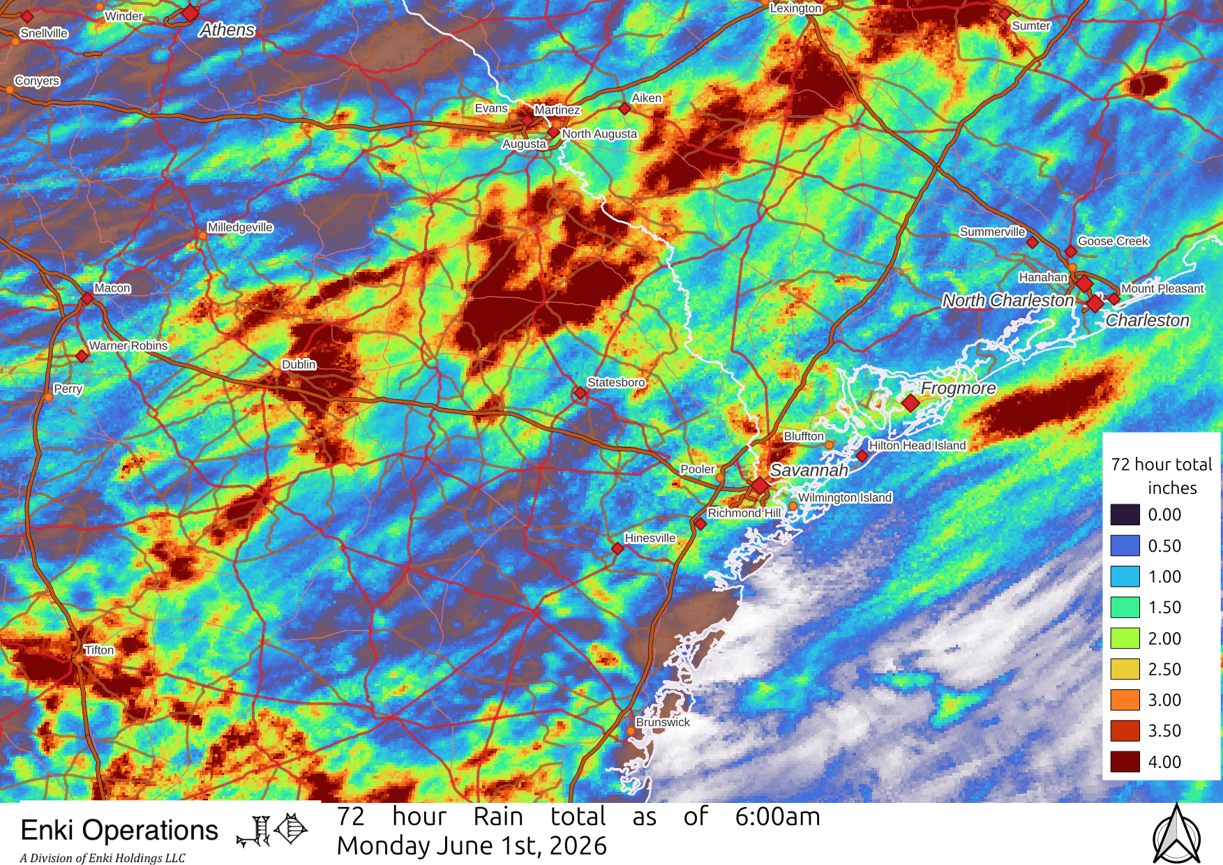
Finally got some significant rain in Coastal GA/SC, but still spotty. In Midtown Savannah we got 1.58″ so far, some places got over 4″, some got skunked:

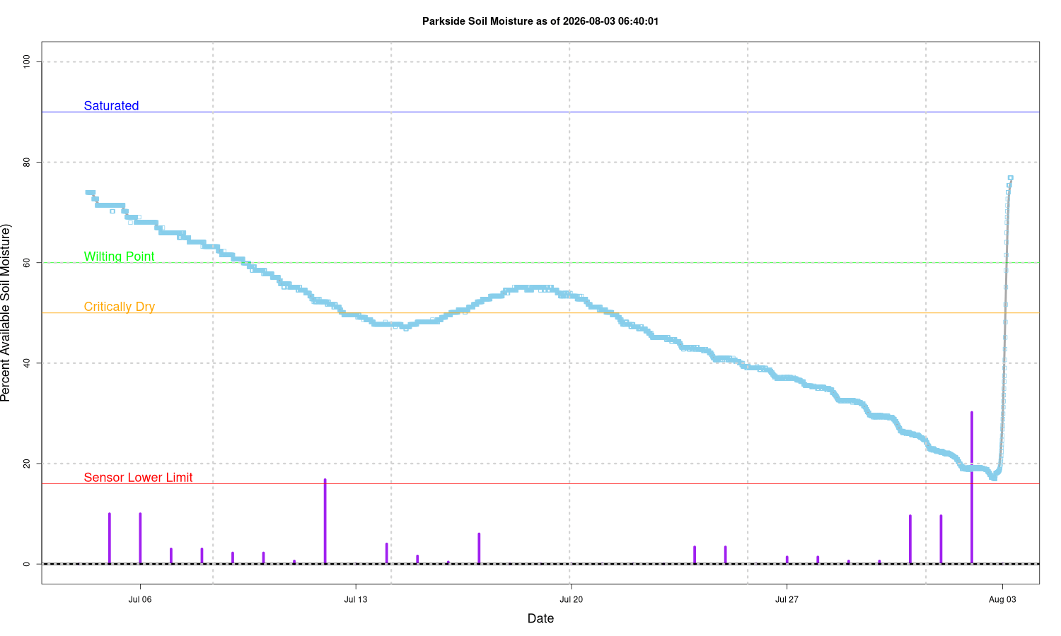
It really helped our upper soil moisture, that had been cratering lately as we had been missed by the previous thunderstorms. This shows how depleted the deep soil moisture still is, 10 of the last 12 months have been below normal rain. Blue line shows the soil moisture at 6″ below the surface, the purple lines are showing rain events:
Zooming out a bit you can see that a band inland got a lot more. Another round is expected this afternoon, hopefully the areas missed yesterday will get some today.
If you appreciate the blog, the best way to get it is to subscribe to the emails. You can subscribe and also donate to keep it going at this link. Many thanks to those who have contributed to keep the blog going!
You can also follow us on Musk’s Madhouse X/Twitter (@EnkiResearch), Telegram, BlueSky, or even Fakebook if that is your preferred social media quagmire. But be aware that social media algorithms don’t like to show you posts in chronological order. They “upgrade” sensationalist material, and “downgrade” posts that have outside links in order to keep you on their platform, so it’s not a great way to get weather warnings or news (or anything other than a variety of psychiatric symptoms for that matter).
>>Tracking is pretty tight.
That’s almost an understatement. The storm seems to have a bead on Naha.
Temps in the region are running high as well – which I guess means this one won’t weaken much until it eats some land. (A shout out to recovery workers in Kumomoto working in 40+ degree heat.)
Thank goodness for the mid town rain pops today!!!!!!