

TL;DR: swell (waves) from Fausto should reach Hawai’i tomorrow, uncertain how much wind/rain. Typhoon Noul landfall today near Hong Kong (tonight in China) and is already causing some damage. Atlantic quiet.
Hurricane Fausto continues to trek across the Central Pacific. It’s a race between weakening due to colder water and the distance to Hawai’i. Here are CPHC’s Key messages regarding Hurricane Fausto (en Español: Mensajes Claves), and this is what the forecast looks like using my TAOS(tm) hazard model:
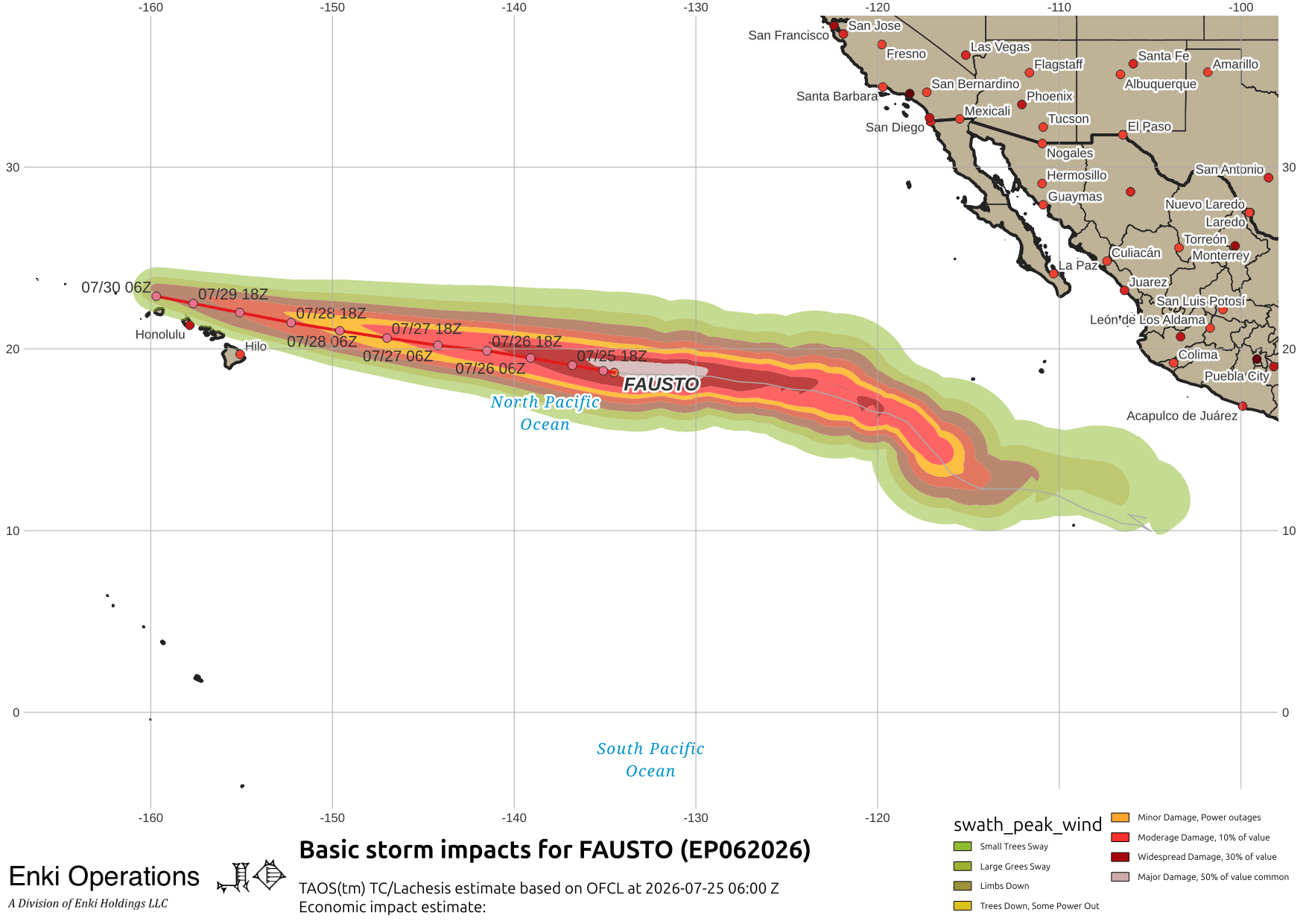
There are two things to watch. First up are waves. Big storms in open water generate swell – long period waves that can travel far across the open ocean. Good for experienced surfers, bad for the average person. These should start reaching the eastward facing shores of Hawai’i tomorrow, creating rip currents and other hazards.
The second thing is wind and rain. That depends on intensity and exact track. As for tracking, the models are fairly tight, but still show a range of possibilities just north of the Islands:

a wobble south brings Fausto – or what’s left of it – directly over them. The other factor is intensity, and the models are mostly showing a weakening tropical storm by that time (120 hours or five days from now):

There are no watches or warnings at this time, the guidance is to “monitor”. Monday will probably be “action day” (or “meh day” depending on how things evolve).
The other storm we are watching is Typhoon Noul, and there’s no doubt it will cause damage to China in the area around and north of Hong Kong:

Model estimates are for over $5 Billion in economic impacts, with 73 million people in the potential damage swath. There are already reports of damage as the fringes of the storm have reached the mainland.
The Atlantic remains quiet with pressures high, blobs of dry air, and wind shear over the far Eastern Atlantic …

If you appreciate the blog, the best way to get it is to subscribe to the emails. You can subscribe and also donate to keep it going at this link. Many thanks to those who have contributed to keep the blog going!
You can also follow us on Musk’s Madhouse X/Twitter (@EnkiResearch), Telegram, BlueSky, or even Fakebook if that is your preferred social media quagmire. But be aware that social media algorithms don’t like to show you posts in chronological order. They “upgrade” sensationalist material, and “downgrade” posts that have outside links in order to keep you on their platform, so it’s not a great way to get weather warnings or news (or anything other than a variety of psychiatric symptoms for that matter).