

Still a lot of uncertainty in both the track and intensity forecast for Tropical Storm Melissa this morning, for the official word check out NHC’s Key messages regarding Tropical Storm Melissa (en Español: Mensajes Claves). A hurricane Watch is up for southern Haiti, and an tropical storm watch (likely to be upgraded to a hurricane warning in the next day or so if trends continue) is up for all of Jamaica:

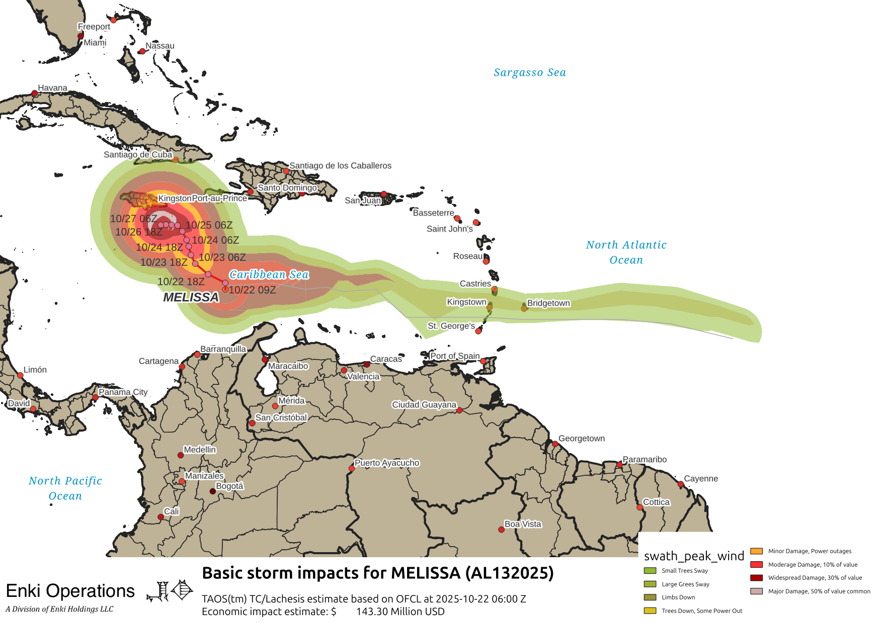
And here is the current estimated impact swath using my TAOS(tm) impact model, based on their new forecast:
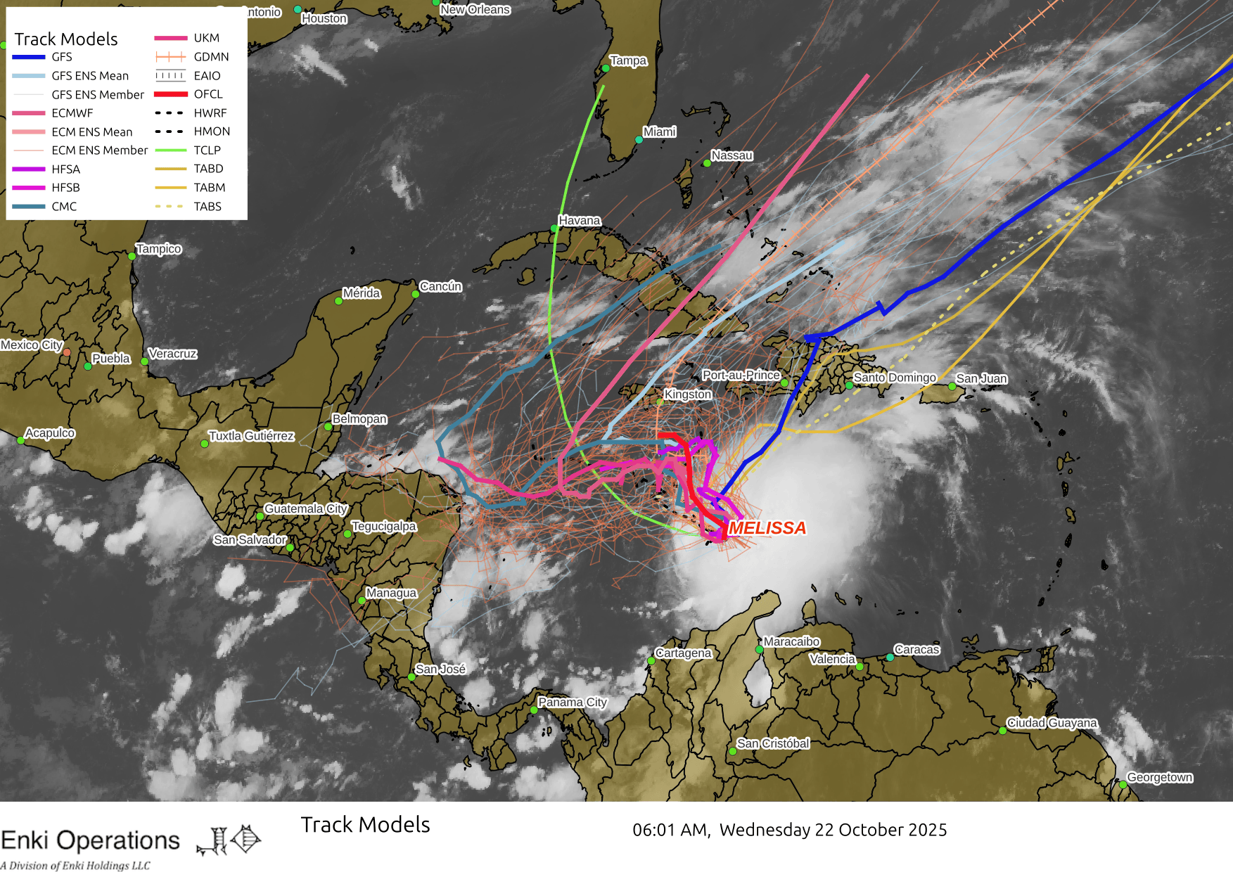
NHC’s official discussion this morning whines incessantly about the uncertainty in the forecast, with justification. For one thing, the center of the storm had to be relocated – that’s not unusual in storms like this where there isn’t yet a distinct center of circulation, but it plays havoc with the models. For another, when a storm stalls out like this it is an indication of weak or conflicting steering. This is seen in the track model maps, which have that “squashed spider” look:
Since intensity depends a lot on track that is uncertain as well. Caribbean waters are warm, but mid and upper level winds are not terribly favorable at the moment. Many of the models, and NHC’s biases, are towards Melissa becoming a strong hurricane this weekend. At the moment, it’s no threat to the U.S., but people in Hispaniola (Haiti/DR) and Jamaica should be preparing for a hurricane late this week, and Cuba needs to be watching warily as well. If it does turn more westward as some of the regional models show, that will still cause impacts in Jamaica, but Central America will have plenty of warning so no need to panic over it if you already have a hurricane plan.