

TL;DR: Nothing to worry about except in the Philippines/Asia.
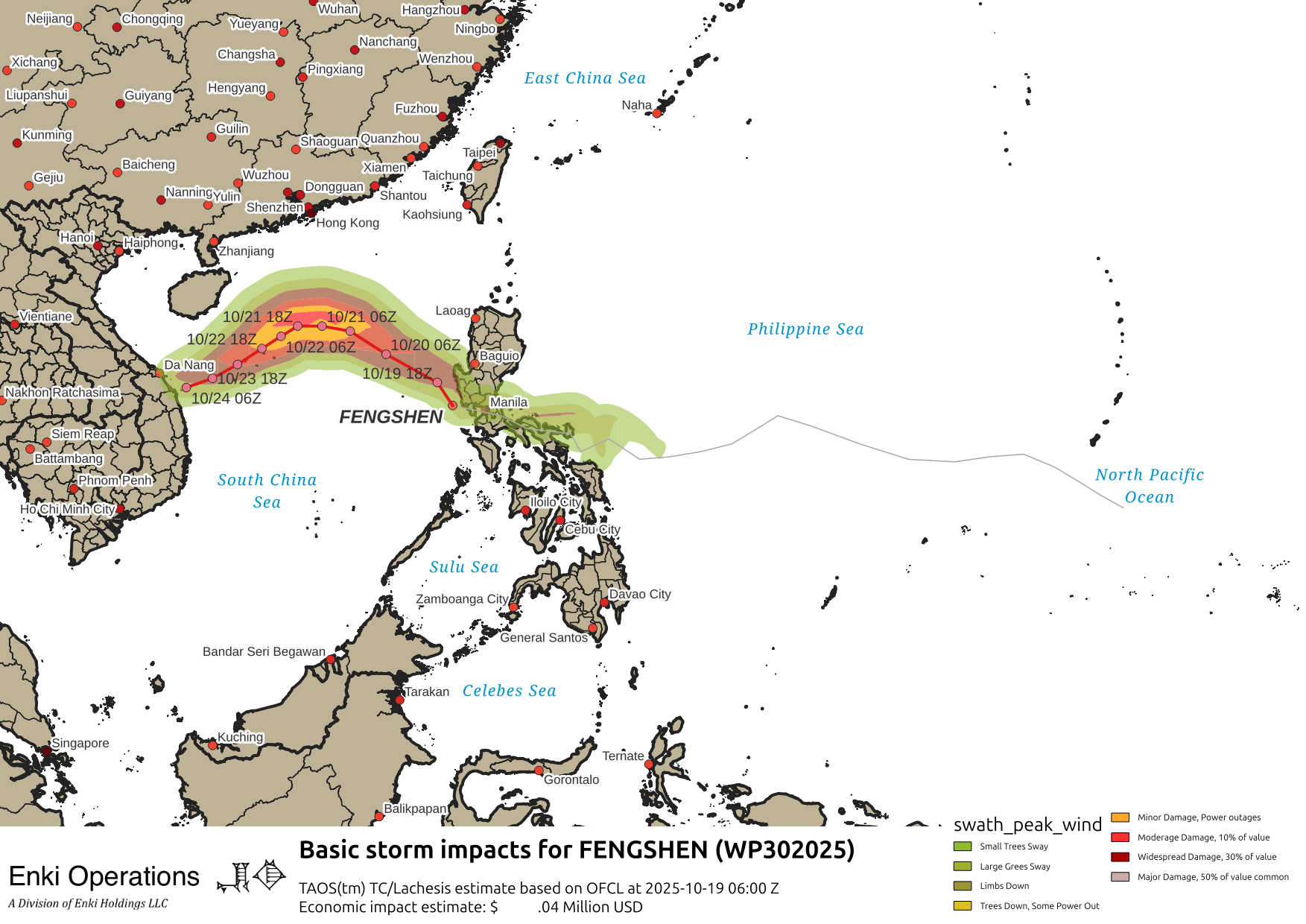
Tropical Storm Fengshen is slowly moving away from The Philippines, having dumped a lot of rain and killing at least five in one family when a tree fell on their house, and forcing thousands to evacuate due to flooding Over the next few days the storm may intensify somewhat before dissipating as it approaches the Vietnamese coast.

There is also a tropical depression in the South Indian Ocean, we will have to see how it evolves as it approaches the islands off of Africa and Madagascar, which is in the midst of political turmoil after a coup as their cyclone (hurricane) season begins …

In the Atlantic, a tropical wave is approaching the windward islands. NHC has it tagged at a 50% chance of spinning up once it enters the central Caribbean.

Although disorganized, the winds in places are already approaching tropical storm strength in places on the north side …

The system has some opportunity to spin up once in the Caribbean, but the GFS tracker loses lock on it. The models show it stopping south of Puerto Rico, then either taking off to the north or continuing west. Yeah, that’s helpful. Either way, nothing to worry about yet, maybe some clarity by mid-week.
