

First, the elephant in the living room, the Israeli attack on Iran:

Otherwise, no comment. On to a marginally safer topic. Tropical Storm Wutip (WP012025) is skirting the west coast of Hainan, now looking to make landfall on the southeast coast of Guangxi province tomorrow. It’s better organized than yesterday, the fact it tracked further West into the Gulf of Tonkin means it is considerably stronger than forecast yesterday, an may even become a typhoon (hurricane) …

On this track, Wutip looks to cause ten times more damage than yesterday’s estimate, with the TAOS(tm) Lachesis impact estimate now between $350 and $450 million USD, with 27 million people in the damage swath …

A little closer to home (well, for me anyway), overnight NHC has started advisories on Potential Tropical Cyclone 4 East (PTC4E). A Tropical Storm Watch is up for the coast of Mexico …
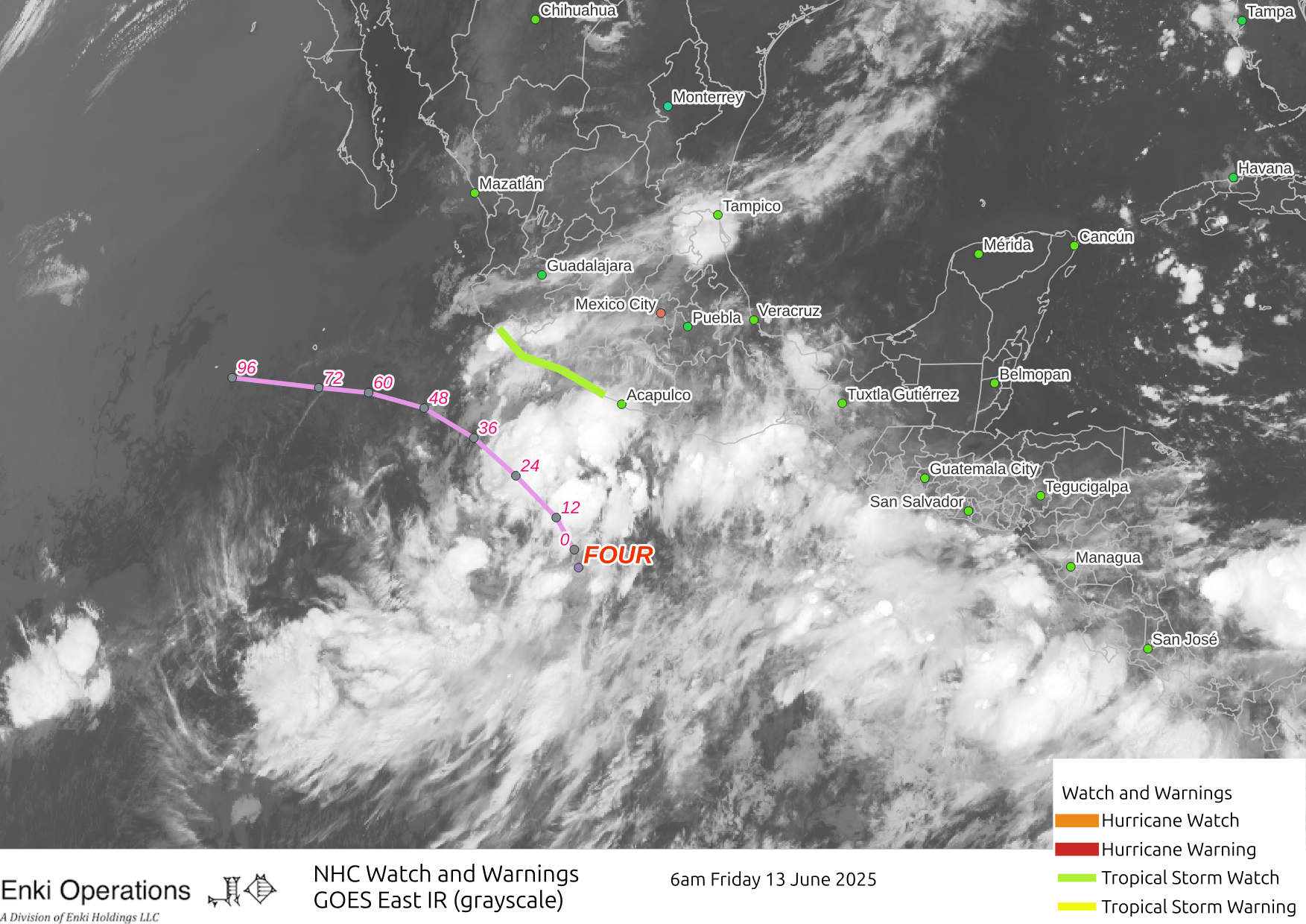
Remember a PTC is a system that technically does not meet the requirements to be a tropical cyclone (depression, tropical storm, hurricane), but might become one, or is causing tropical cyclone level impacts. PTC4E should stay offshore, but might deposit tropical storm force winds along the coast. Like Cosme and Barbara before it, PTC4E will likely become a tropical storm before encountering cooler water and less favorable conditions.
The Atlantic is quiet.
Good morning, Chuck.
The quote is well chosen. I always liked Fred Thompson. Thanks for your insight(s).
Cheers, friend.
Oy vey.
The bad news: this is not going to end well.
The good news: it’s probably never going to end….
waitaminute… I think I messed that up somehow.
I guess it is too late to hope for a hit near DC? Or CA?