

Tropical Storm Ernesto is over the French island (Department) of Guadeloupe at 5am this morning, where warnings are in effect across the Leeward Islands, the Virgin Islands, and Puerto Rico. NHC’s summary this morning is best seen at their Key Messages regarding Tropical Storm Ernesto (en Español: Mensajes Claves). Ernesto looks better organized this morning, but still only minimal tropical storm winds. Here’s the IR view (sun isn’t up yet), forecast track, and warnings …
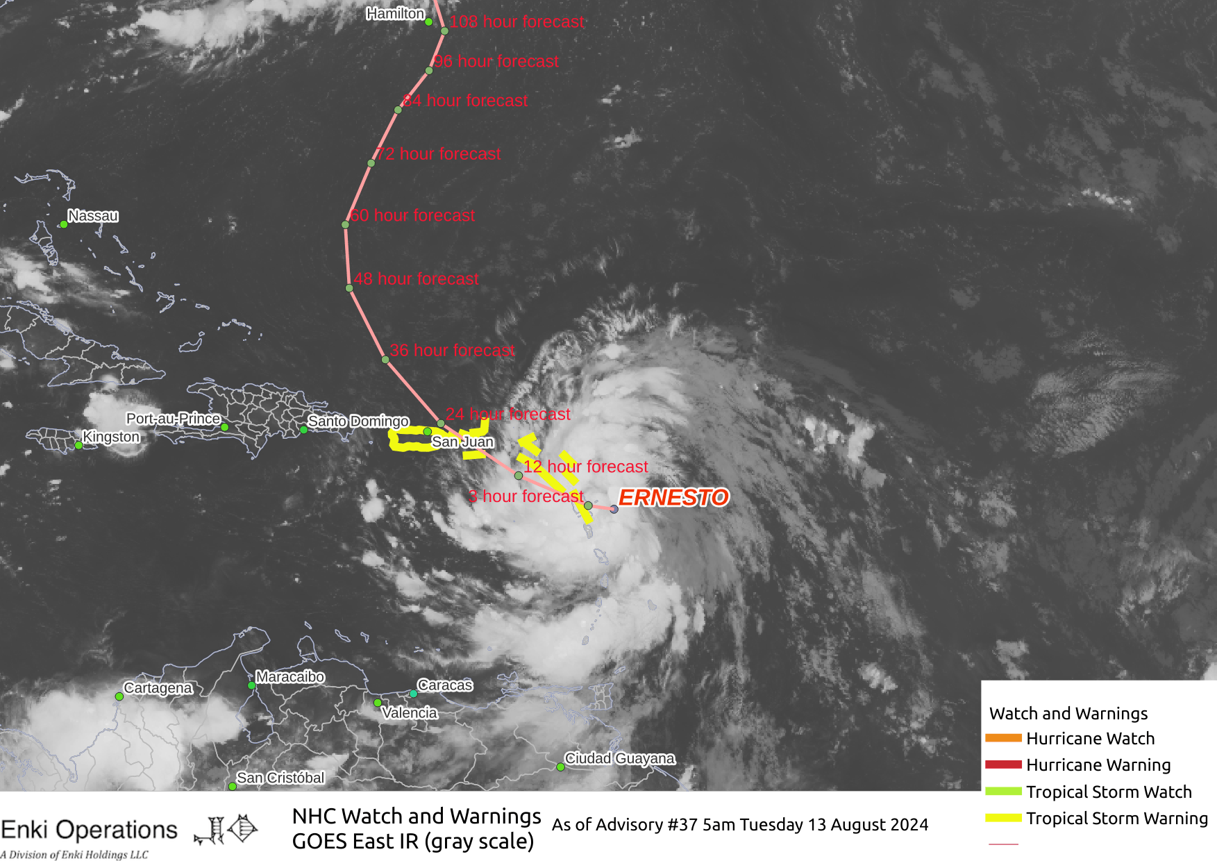
The forecast is pretty straightforward, with the track models consistent with the storm making a turn to the right right turn over and north of Puerto Rico late today/early tomorrow, then heading north over the open (and very warm) Atlantic …

On this track the storm will encounter favorable conditions and should become a hurricane by this weekend. At the moment the forecast is for Ernesto to slow down very close to Bermuda as a strong Category Two (almost Category Three) storm. That would be Bad, and will need watching as we get closer to the weekend. There is no significant risk for the rest of the US on this track.
Conditions across the northern Caribbean will deteriorate further during the day today both due to the proximity of the storm as well as Ernesto is forecast to strengthen during the day. The Virgin Islands and Puerto Rico will experience 50 to 60 mph winds if the forecast holds – here is a closer view of the impact maps for the Leeward Islands through Puerto Rico …

Although the wind will cause some damage, a bigger concern is flash flooding and mudslides. Rain bands are already being seen on the San Juan radar:
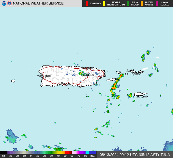
In short, stormy day with heavy rain and winds, and the risk of mudslides and flash flooding the biggest worry.
If you like this kind of commentary you can subscribe to the emails (and/or donate to keep it going) at this link. You can also follow us on X/Twitter (@EnkiResearch) or Facebook if that’s your preferred social media dystopia.