

The biggest thing to watch today is Hurricane Polo, making landfall on the Baja peninsula. It’s not a densely populated area, but economic impact estimates range from a low of $50 million to as much as $500 million depending on how the rain, flash flooding, and related impacts end up.
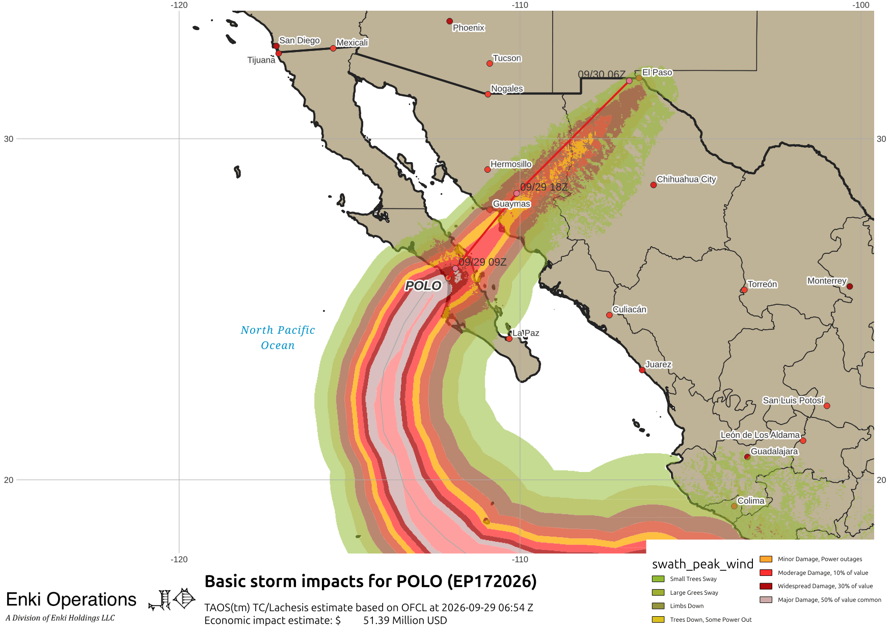
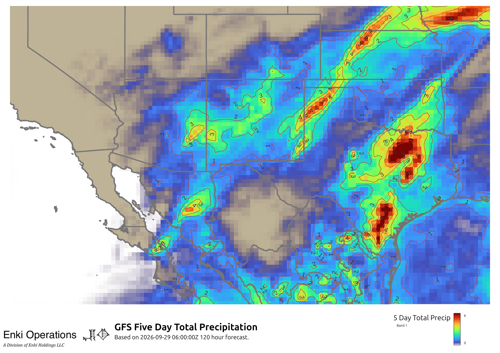
Here are NHC’s Key messages regarding Hurricane Polo (en Español: Mensajes Claves). Polo will drag a lot of moisture into the desert southwest. when it collides with other systems moving across the US it promises to dump some locally heavy rain totals in areas of Arizona and New Mexico that don’t get a lot of rain. Some areas of Texas also look to get upwards of 6″ of rain this week:
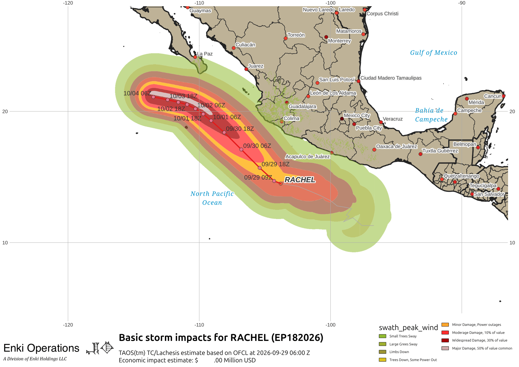
Another hurricane, Rachel, is paralleling the Mexican coast. The outer rain bands will brush the coast, with waves and rip currents being the major threat. The worst should stay well offshore …
Finally, there are fishy storms in the Atlantic, all far from land. Tropical Storm Hanna spun up yesterday, but should be short lived, as Fay heads west but is fading, just barely a tropical storm but may be a depression by the time you read this …


Notice the lines on the left side of the tracking map (left map, click to embiggen)? That’s the remants of Polo dragging rain into the midwest.