

Lowell is well into its turn to the north, and as often happens when a storm suddenly changes direction in response to powerful steering it dropped a category, but it’s still a Category 3 hurricane and should remain a very powerful storm. The latest CPHC forecast and TAOS(tm) TC impact model keeps it enough west of the main islands so that at worst tropical storm level impacts should be felt there.
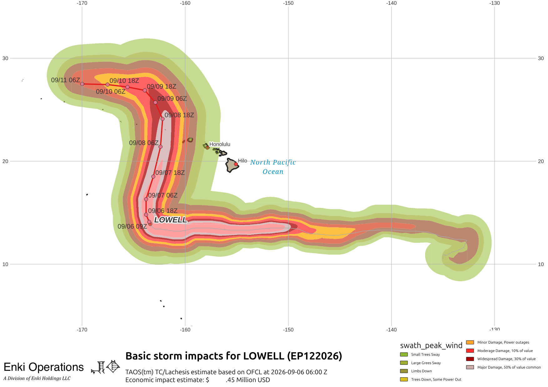
Here are links to the CPHC Key messages regarding Hurricane Lowell (en Español: Mensajes Claves). A tropical storm watch is up for Kauai/Niihau, and a hurricane watch is up for the Papahanaumokuakea Marine National Monument from Nihoa to French Frigate Shoals. These watches should become warnings later today.

Karina is fading out and should dissipate north of the Islands. Marie (off the right edge of this map) is of interest only to fish and fish related activities. There will be a lot of swell and very high waves around the islands for a few days so unless you are really experienced don’t mess with them.