

TL;DR: increasing potential for a storm in the Atlantic, but likely to be of interest to fish and fish related activities. Pacific is super busy. And some reminders about how to watch storms that doesn’t involve Xanex or wearing out your refresh key.

The disturbance the doomscroller community has been so excited about is now offshore, and has a temporary (INVEST) ATCFID of AL96. For a refresher on what these codes and names mean, and how they change throughout the life of a storm, read this post from last year (link).
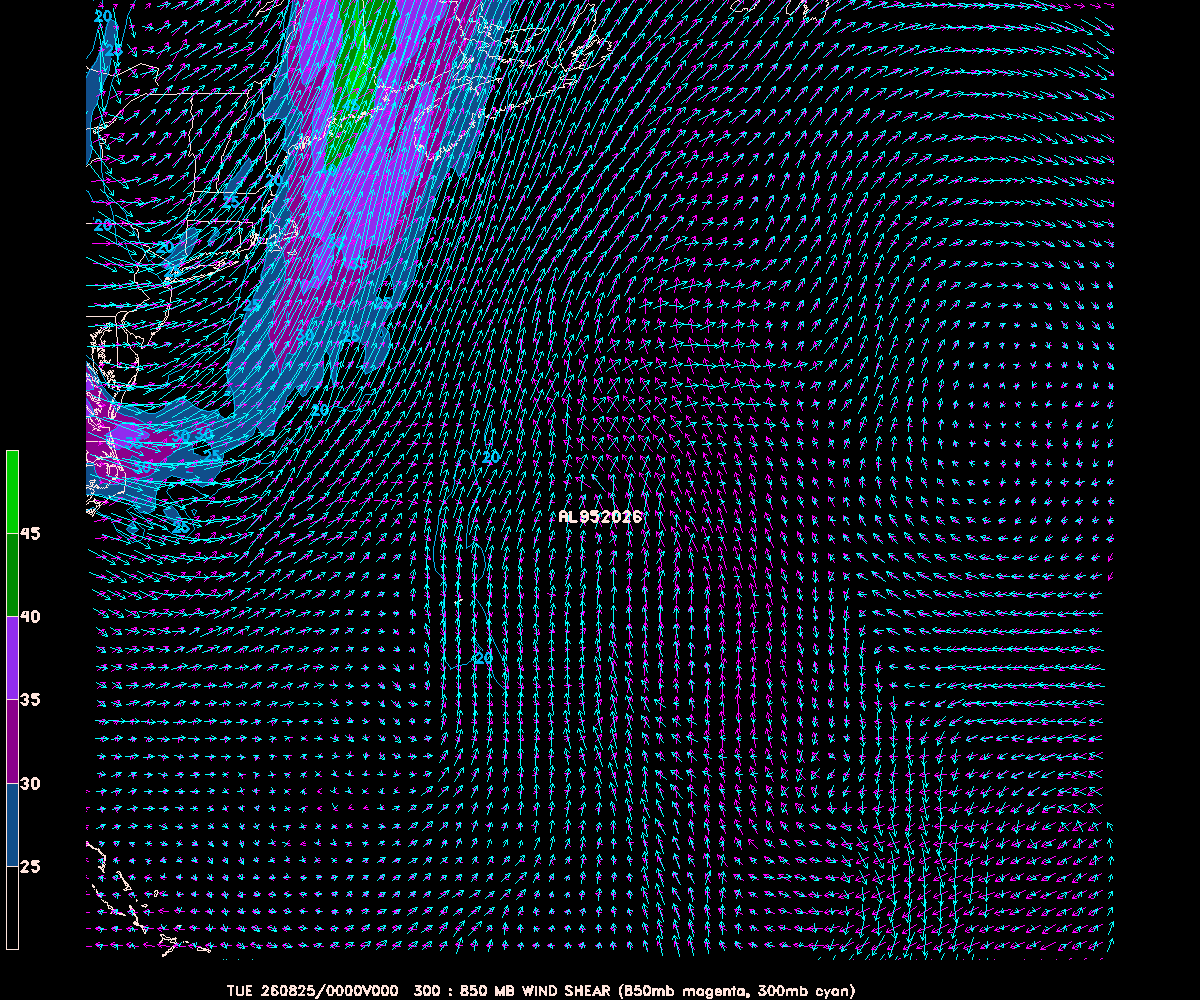
Before looking more closely at AL96, we should look briefly at AL95, the disturbance off the east coast of the US. Although NHC has it at 40%, the window for it to spin up ends this evening. Here is the wind shear in the neighborhood of the storm – notice that to the north, where it is headed, is unfavorable and that region of shear is moving offshore to meet the system …
AL96, to the south, is in a much more favorable environment. But even there, ahead of the storm lies drier air and shear, so by this weekend things aren’t so favorable. Still, a few of the intensity models do bring it near hurricane strength …

Of course, intensity is only half the story – where will it go? We now have dedicated model tracking, so we can start to speak semi-intelligently about that subject. Here are this morning’s computer model runs for both AL95 and AL96 …
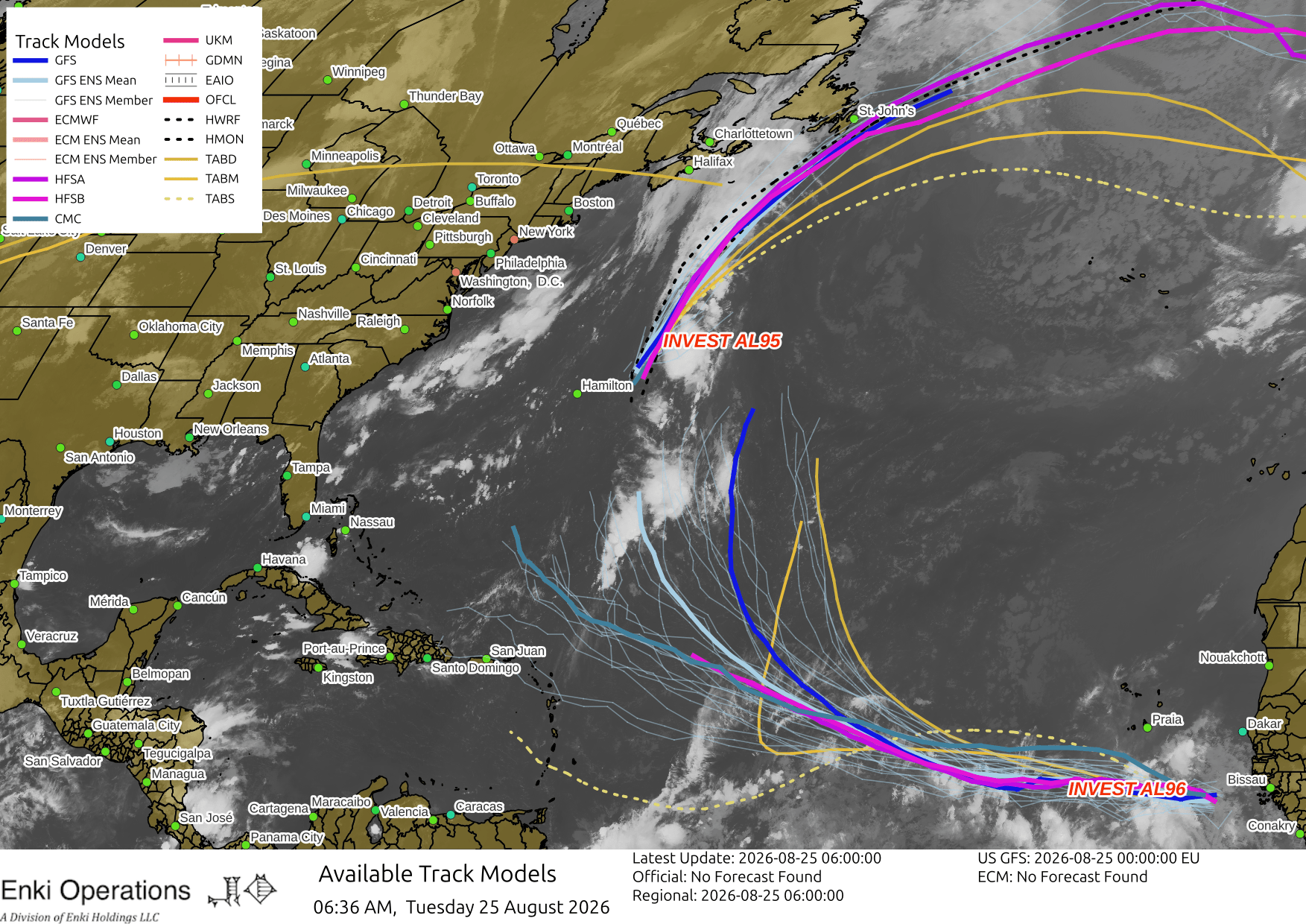
Quite a bit of scatter, but the tracks for AL96 that are more towards the Caribbean or East Coast are basically tracking a nearly-dead low, the “real” storm tracks are the ones (like the dark blue GFS line) that curve well off-shore. GFS is the most enthusiastic about this one, ECM determinstic and AI versions not so much. Here’s the GFS (left) and ECM AI (right) in three days …


So, in short, this storm isn’t anything to worry about at this point or likely ever. Still, it’s a reminder that it’s hurricane season, we are just now reaching the peak of average activity, so if you’ve raided your emergency Cheetos stocks top them off, check your plans, and think about what you might do if a real storm shows up.
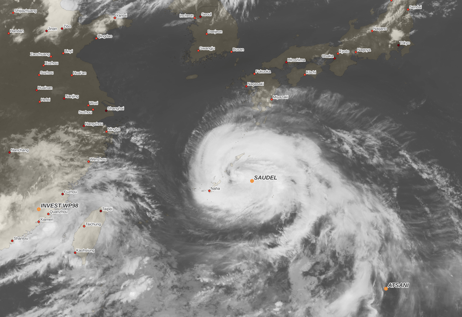
If you want real storms you have to go to the West Pacific, where Typhoon Saudel is starting to impact Ryuku Islands and Okinawa. The sun just set out there, but here’s is the current (7am) InfraRed image from Himawari 9 (the Japanese version of GOES):
As noted the situation out there is complex, with four systems interacting with the surrounding weather patterns …
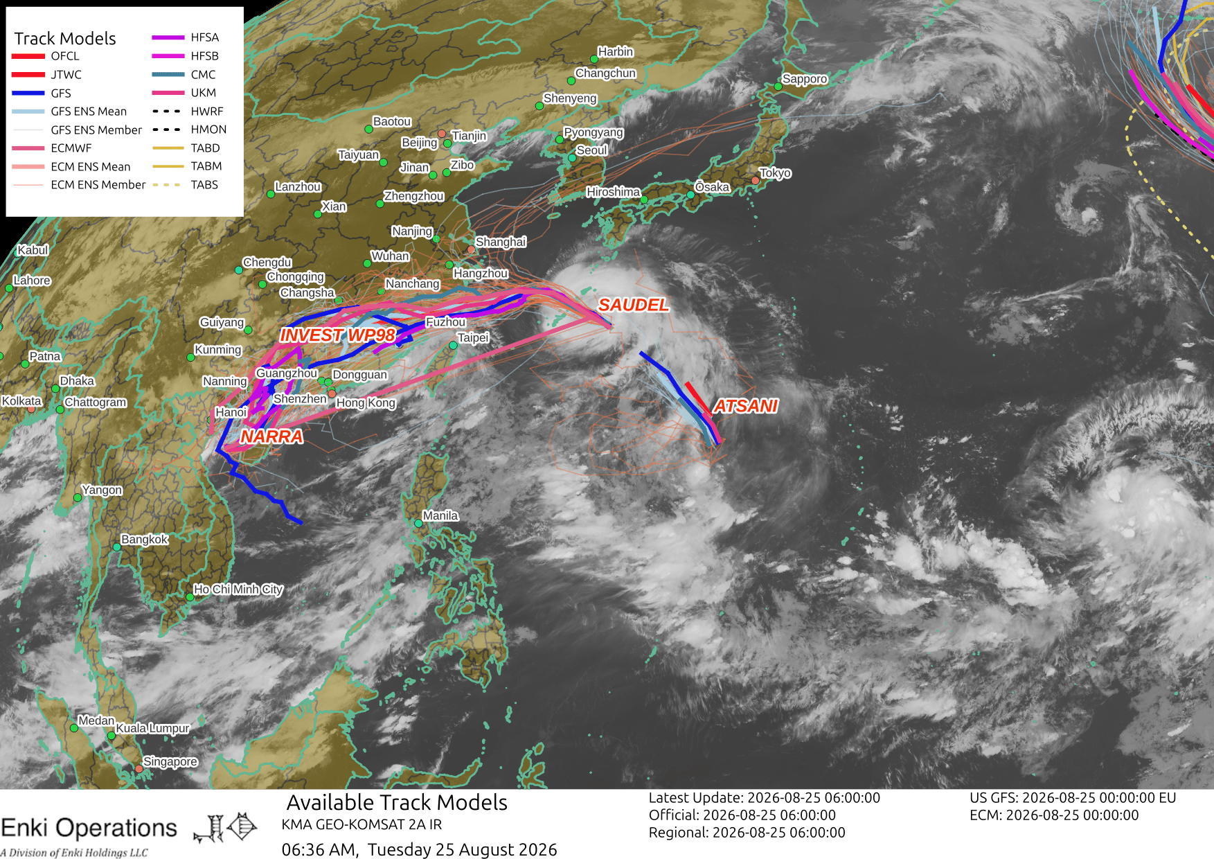
On this track and forecast it could cause quite a bit of damage both in southern Japan and China, model estimates are over $1 Billion in total:

Tropical Storm Moke has broken up and CPHC discontinued tracking last night. There are also two storms in the East Pacific between Mexico and Hawai’i, they should stay as fish storms (and one of them, Iselle, is shearing apart the other (Julio)…

If you like this commentary you can subscribe to the emails, which is the best and only really reliable way to get them, and/or donate to keep it going, at this this link. You can also follow us on X/Twitter (@EnkiResearch), Telegram, BlueSky, or even Facebook if that’s your preferred social media mayhem.