

Quick updates on Typhoon Dolphin and Savannah area rains. Typhoon Dolphin continues to track directly towards Okinawa:

It remains impressive on IR this evening (Okinawa time, 6am ET), and heavy winds and rain expected there on Friday as the storm passes over or near the islands …


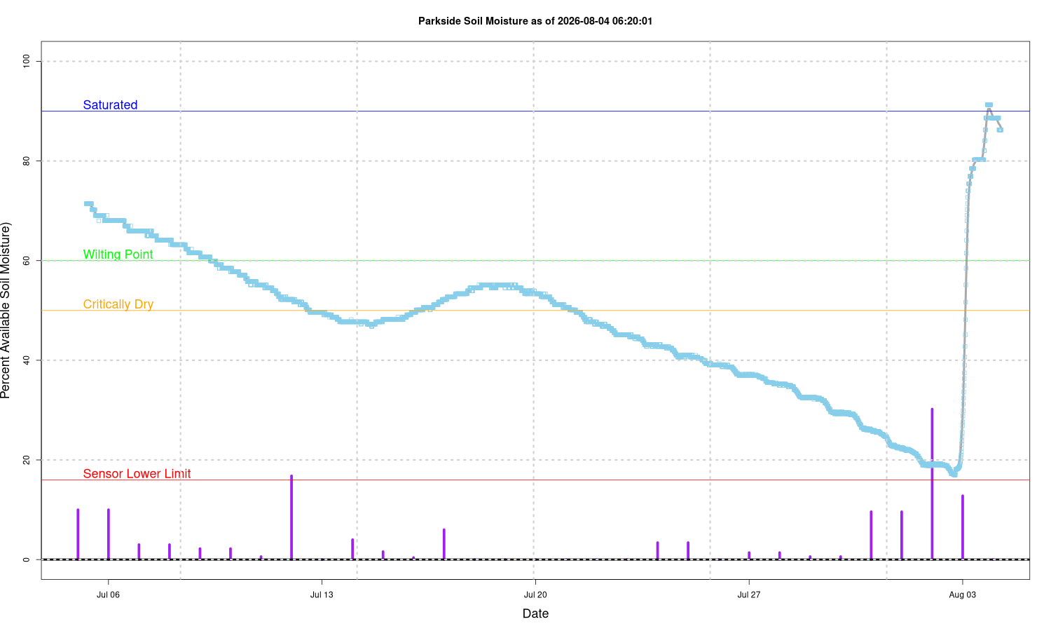
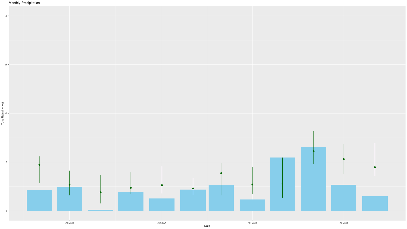
The Enki gauge in Parkside (mid-town Savannah, 203,908 feet southwest of Frogmore) got 2.15″ of rain out of the last two days. It’s helped, with soil moisture recovering, but we are still way behind on rain as the second graph shows the monthly totals over the last year (dots show average, vertical line the 25% to 75% normal range).
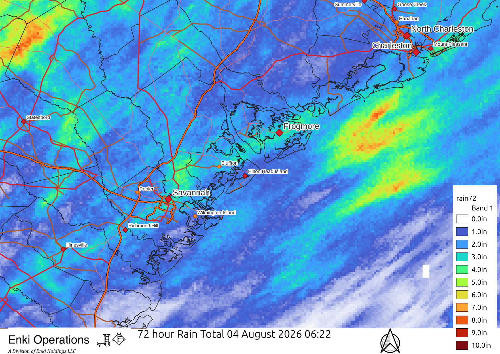
Across the region most areas saw at least some rain, but as is typical with convective (thunderstorm) rain events totals varied a lot, from under 1/4″ to over 5″ …
Dry are is pushing in behind the front. Humidity should be much less insufferable the next few days, you don’t need much meteorology training to see the difference in this mid-level water vapor image from GOES East this morning – brown is dry, lighter colors have more moisture in the air …
