

Last night NHC upgraded TD2 to Tropical Storm Bertha: Key messages regarding Tropical Storm Bertha (en Español: Mensajes Claves). Here’s the current radar and rash of warnings across the northern Gulf coast …
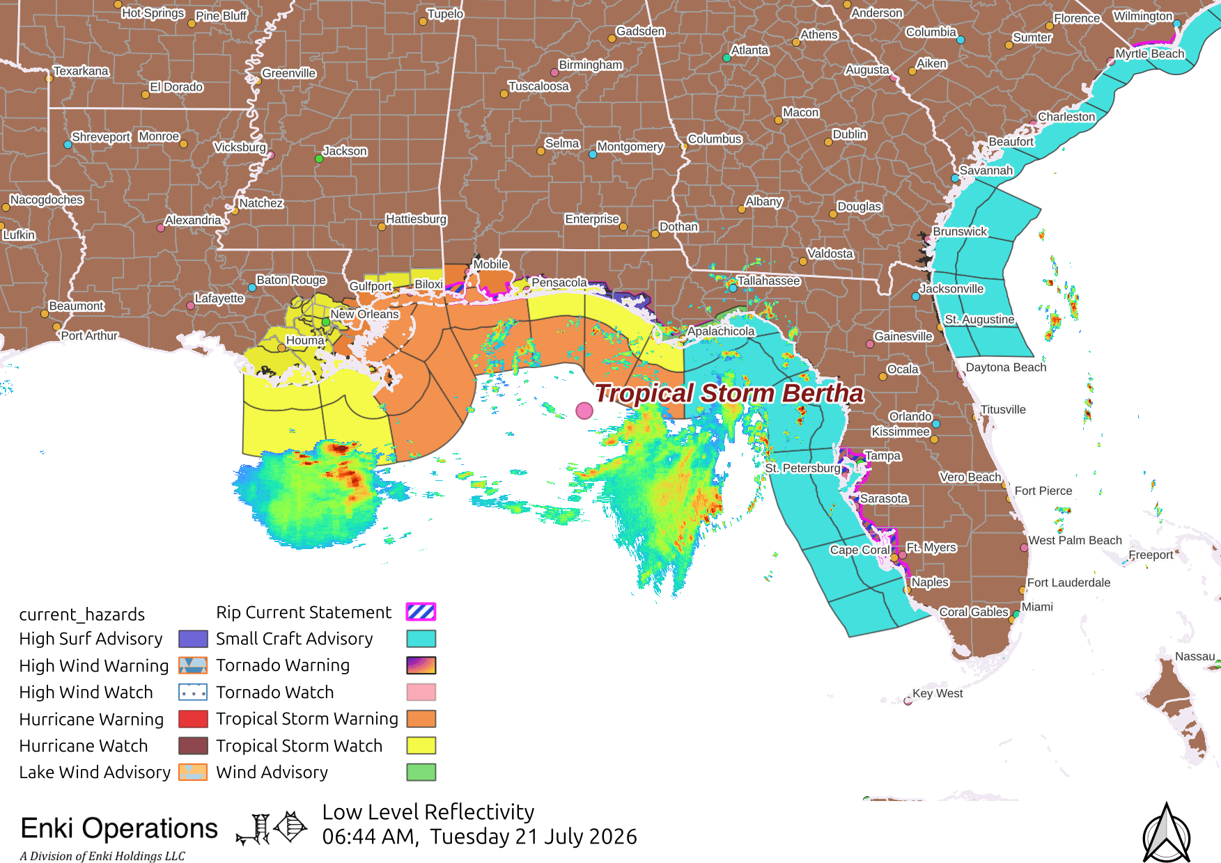
This is not a classical storm structure, it’s highly sheared, and given the proximity to land and other factors, it shouldn’t get much stronger. Higher winds should stay offshore, with the worst of the effects confined to the immediate coast, although there may be some breezy winds and thunderstorms inland. The latest global model runs keep most of the rain offshore …

Storm surge should be minimal, just low lying marshes and a foot or so above the normal high tide levels. Still, if you are in the warned areas, take appropriate precautions.
I still see a lot of abuse of the NHC uncertainty cone (the “cone of shame”). Here’s the current cone for Bertha (in purple) along with the watch and warning areas, as well as the TAOS/TC wind field impact forecast overlay …
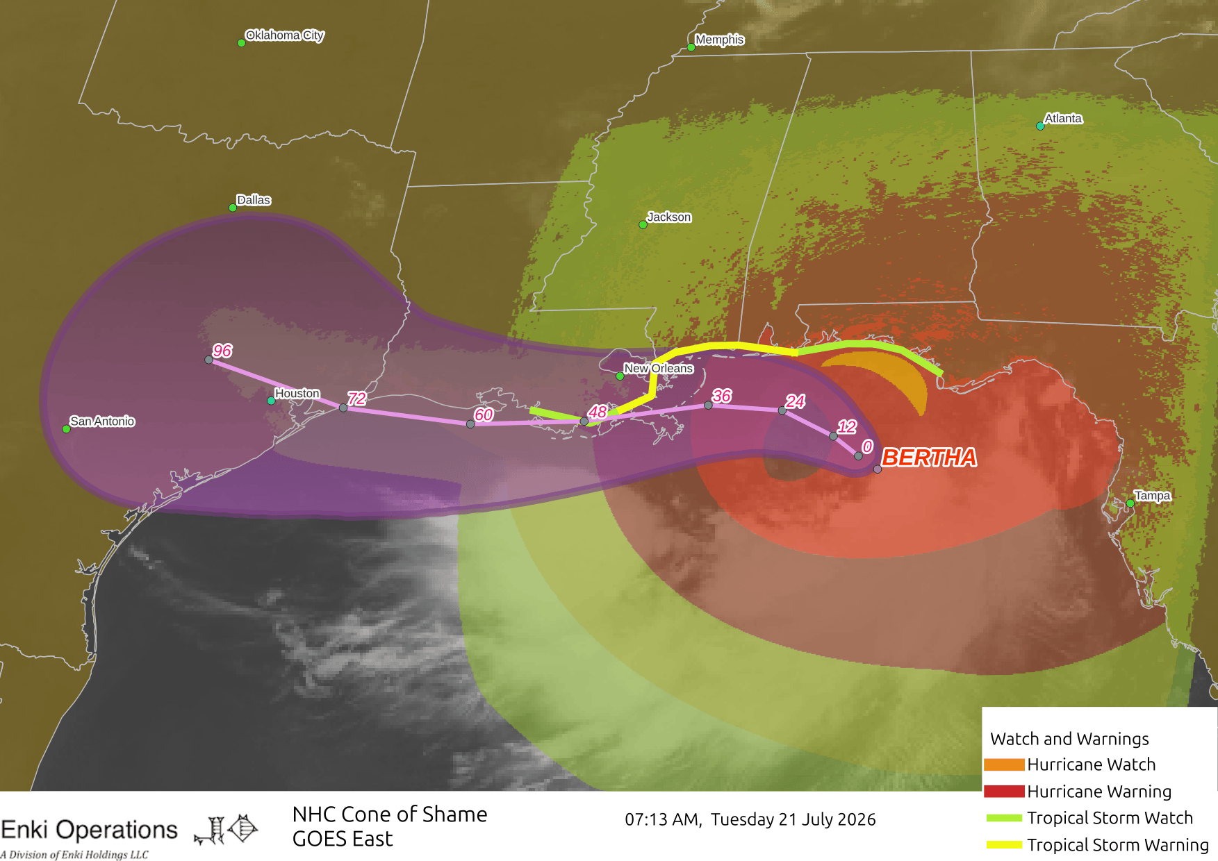
As you can see, the cone doesn’t even cover the watch and warning areas, much less the area of the wind field! It is vital to understand that the cone is the area within which there is a 67% chance the storm center will be on average. It is a useful tool to evaluate the forecast uncertainty, but it is a terrible graphic to use to understand the impact of the storm. Given storms are 100’s of miles across, hazardous, even dangerous impacts can lie well outside the cone! Likewise, with a dissipating storm like Bertha will be by the time it reaches Texas, the cone can exaggerate the danger zone. That’s why I rarely show it. If I want to talk about uncertainty I’ll show the track forecast maps and use other tools.
If you appreciate the blog, the best way to get it is to subscribe to the emails. You can subscribe and also donate to keep it going at this link. Many thanks to those who have contributed to keep the blog going!
You can also follow us on Musk’s Egostroker X/Twitter (@EnkiResearch), Telegram, BlueSky, or even Fakebook if that is your preferred social media quagmire. But be aware that social media algorithms don’t like to show you posts in chronological order. They “upgrade” sensationalist material, and “downgrade” posts that have outside links in order to keep you on their platform, so it’s not a great way to get weather warnings or news (or anything other than a variety of psychiatric symptoms for that matter).