

Update: at 8am, odds boosted, and advisories likely. NHC has been slowly bumping up the probabilities of at least a tropical depression forming in the Gulf, now at 60% (double from Friday’s 30%). What changed, and should you worry?
Here’s the NHC Tropical Weather Outlook formation zone forecast from Thursday (left) and today (right, click either to embiggen):

The guidance originally suggested the low developing near Florida would drift northeast across the peninsula, thus limiting development this weekend, and there wouldn’t be much potential until tomorrow. Instead, it stalled and instead began drifting more northwest. This has kept it in a (slightly) more favorable environment.
But conditions still aren’t very favorable for rapid intensification. The RAMMB analysis shows a lot of the parameters they look at as unfavorable, the consensus for the storm becoming a strong tropical storm is only 1 in 3 using the most optimistic parameters, the consensus estimate about 1 in 5 (20%).
So the TL;DR is that there is heavy rain potential, maybe breezy on the coast, outside chance it could become a named system, but mostly out of caution because it is so close to shore and NHC will want to make sure warnings go up just it case. At present it looks like the worst reasonable case is for a weak tropical storm impacting the panhandle of Florida, Alabama, Mississippi, or Louisiana. As always, the best guide is what NHC is saying:
Interests along the northern Gulf coast from Florida, Alabama, Mississippi, to Louisiana should monitor the progress of this system as it is expected to bring heavy rain to portions of that region during the next several days.
If you just have to have the fancy graphics or love the weather details details, read on. Here’s what it looks like this Sunday morning on the infrared loop …

And here are the model tracks. Notice the table is blank because we don’t have enough info to compute track errors yet …

As noted above, the intensity guidance isn’t very enthusiastic, most estimates keeping it at or below tropical storm force. Beware doom-bloggers who cherry pick models like HWRF that show the storm jumping to hurricane strength with impressive graphics. Here is the intensity forecast from a variety of models:

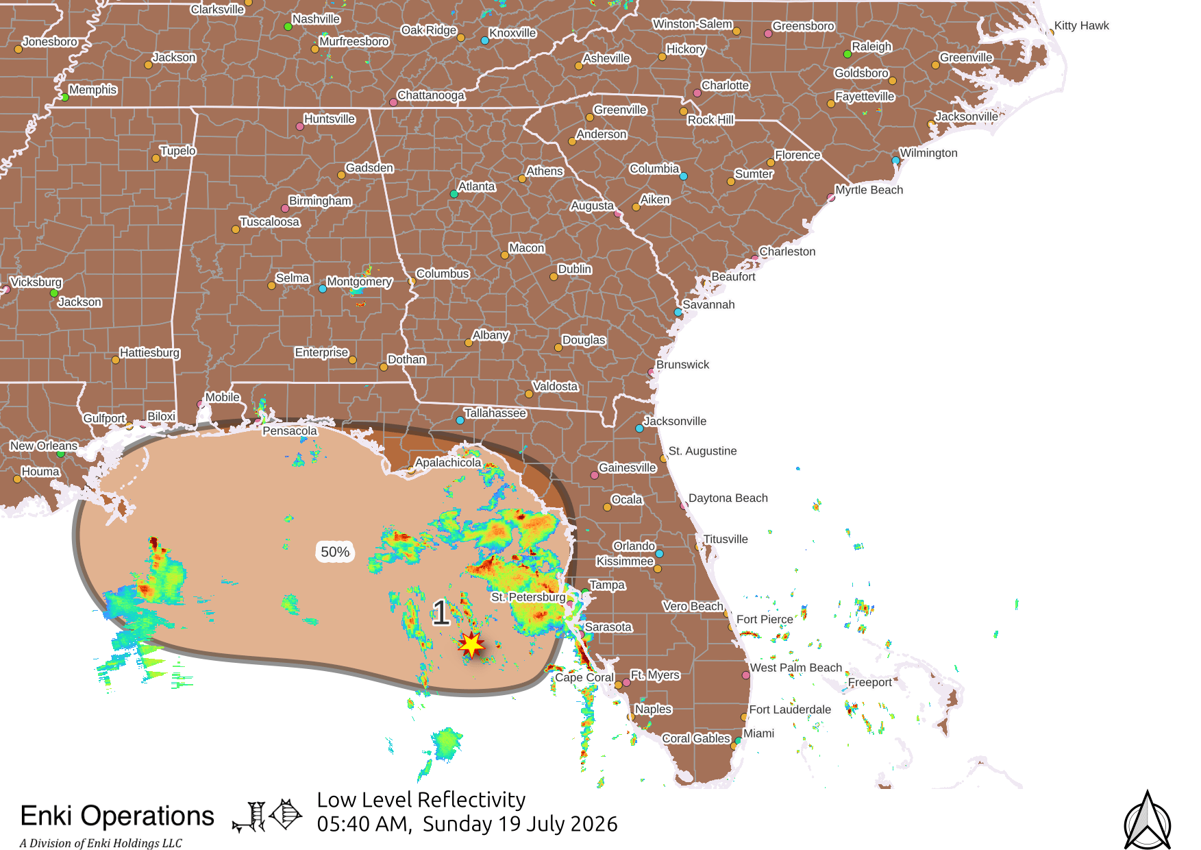
There is a lot of rain on radar just offshore.

It may stay out there, but if it does move onshore flash flooding is a real possibility so if you are in areas vulnerable to that along the Gulf Coast beware. Further inland and north, including Georgia and the Lowcountry, we’re far enough away it’s (unfortunately) not likely we will get significant rain from this system, so another few miserable high heat-index days until the next significant chance of rain on Thursday.
Will look again in detail Monday Morning unless something dramatic changes.