

NHC’s Yellow Blob of Doom (BOD) in the northwestern Gulf has shifted west with the guidance now showing the low headed that way rather than across Florida and into the Atlantic. And in the wide view, notice the BOD in the East Atlantic is, as expected, no more …

Zooming in a bit and adding in radar, you can see the cluster of showers around off the Ft. Myers/Naples area that is expected to move north and (maybe) threaten to organize …
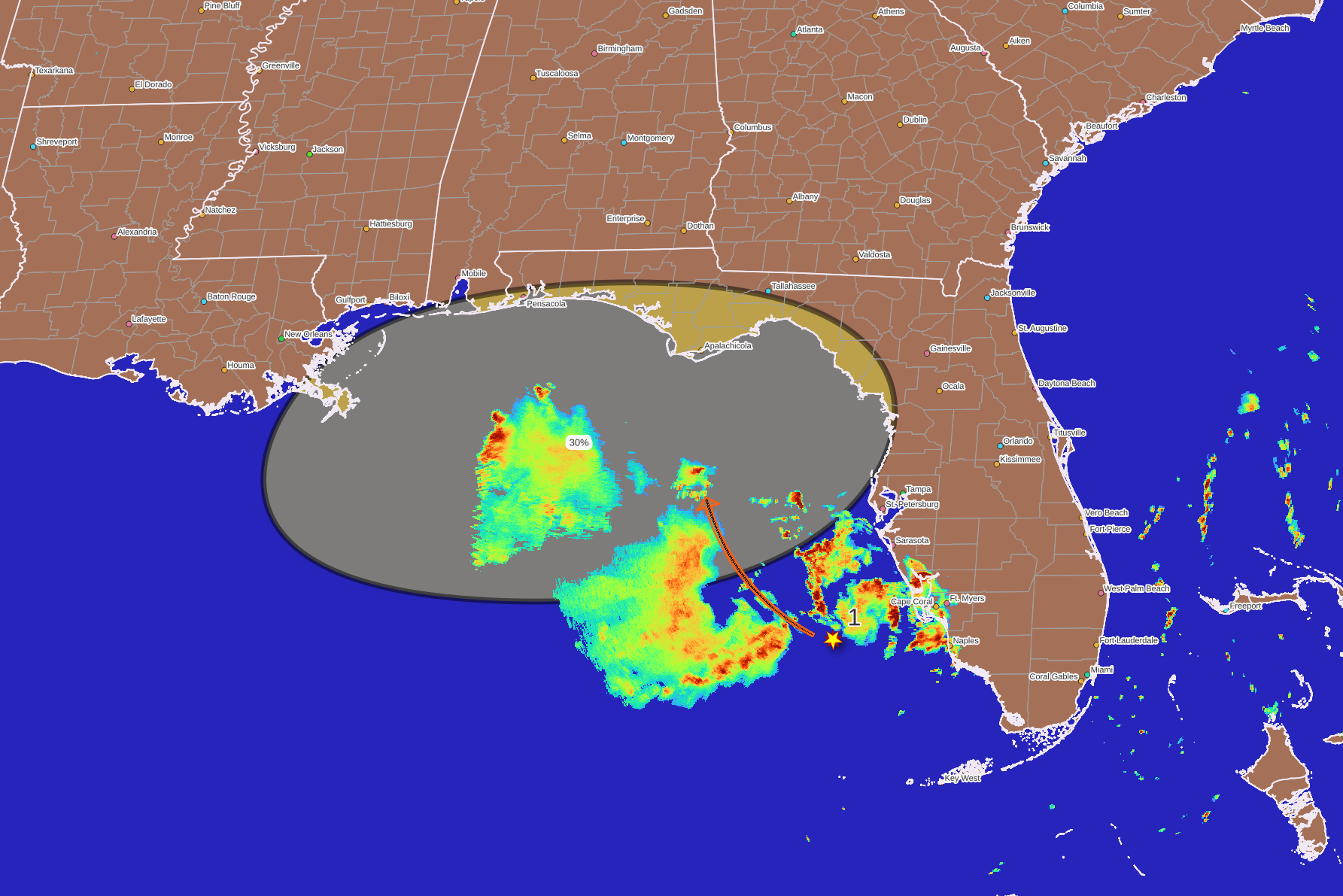
So what does all this mean? At the moment, not much. There are no “magic words” in the NHC outlook, which means there is no need for anybody to do anything, even “monitor.” And for sure don’t doomscroll. A daily glance at the TWO is fine. Those in Florida near the disturbance may get rain, potentially a lot all at once so the usual places that get flash floods should watch for that, but also true if it’s a bit more offshore you might get nothing. So far we’re not looking at the potential for a mature tropical cyclone with high winds and storm surge – still only 30% of even a depression, but I expect that to go higher. At the moment this is just a disturbance, not even an invest (although that is likely coming). Another factor is that it is so close to shore, I would’t be at all surprised if at some point NHC doesn’t tag this as a “potential tropical cyclone” if trends continue. But that’s next week. All together, we’re now at “elevated levels of Meh” so enjoy your weekend, if on the West coast of Florida watch out for heavy thunderstorms.

FYI, in the East Pacific, we have Tropical Storm Elida, which hasn’t developed as quickly as expected. It’s well offshore and it, as well as another system behind it (Invest EP91, which should get upgraded soon), are expected to stay that way …

Surprisingly, nothing in the West Pacific at the moment.
Thank you for your dedication to keep us informed!