

TL;DR: coastal GA/SC are under a flood advisory, as well as rip current warnings. These will likely be changed to flood watches and warnings today, possibly through mid week. Note this is confined to areas adjacent to the marshes and coastline – it’s not a generalized flood threat! Wind advisories are also likely with gusts over 30mph, and Gale warnings offshore.
A high to the north, and a low to the south on top of higher than average astronomical tides (full moon, near equinox, and perigee – the moon closest approach to earth) are ganging up to bring strong northeasterly winds into the Georgia and South Carolina coasts the next few days …
Here is the coastal flooding threat matrix as of this morning from the Charleston SC NWS office:
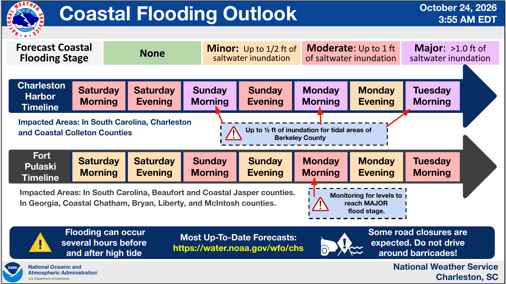
For areas around and north of Frogmore (Beaufort/Fripp), the high tides Sunday, Monday, and Tuesday are all of concern. For the Savannah area, the tides Monday and Tuesday are of highest concern. In fact, Monday’s high tide might set a record for high water outside a tropical storm or hurricane …

Since records began in 1935, the Ft. Pulaski gauge has never breached 10.5 ft (Major flood stage) outside a tropical system.
What does this mean? For most people just a breezy few days that will knock the leaves off the trees just in time for Halloween. But if you live on the immediate coast next to the marshes, there may be some flooding. The road to Tybee (US 80) will probably be blocked for a few hours Monday and Tuesday morning, so be alert for that. You can monitor the tide forecast at this link (click).

Northern Hemisphere hurricane season isn’t over yet. In the far Western Pacific, the battle of the machines has ended as it usually does, both the deterministic and AI driven forecasts were partly right and partly wrong, but I’d give the clear edge to the deterministic runs since they showed a more direct hit on Taiwan than the AI track models. It has collapsed in intensity due to the interaction with both land and wind shear. In any event, Typhoon Champi has killed at least one and left over 600 injured in Taiwan, causing upwards of $10 Billion in economic impacts. The system is brushing the mainland and will continue over southern Japan as a tropical storm, likely causing more mayhem on the way.
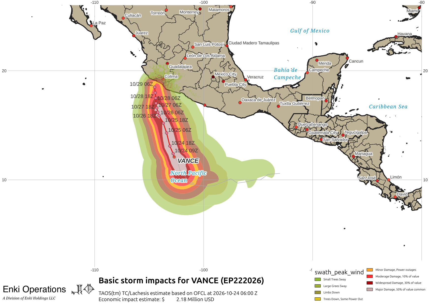
Closer to home, Vance (the hurricane, not the VPOTUS) is threatening Mexico. The forecast is for it to collapse before landfall, but we’ll have to wait and see:
If you appreciate the blog, the best way to get it is to subscribe to the emails. You can subscribe and also donate to keep it going at this link.
While email subscriptions (which are free) are the best way to get these posts, you can also follow us on Musk’s Madness X/Twitter (@EnkiResearch), Telegram, or BlueSky.