

NHC still has an orange blob of doom off the US coast …

It now has an INVEST ID, AL932026, and the models are tracking it:

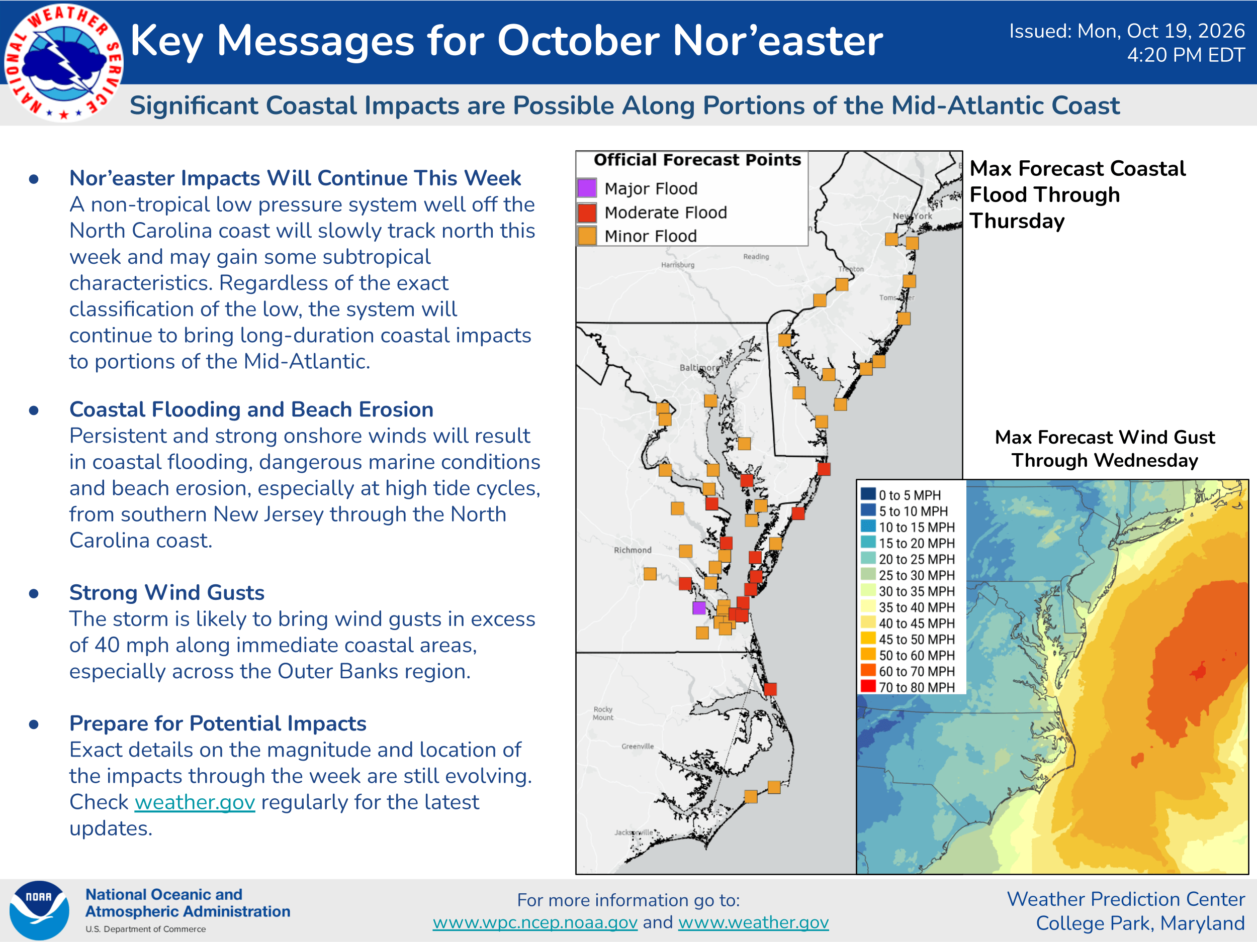
For now it looks to stay offshore. As a reminder, the green line is climatology for reference – how storms there have historically moved at this time of year. NHC has given AL93 a 40% chance of gainint enough tropical characteristics for them to track it, but eithe way it will produce gusty winds and waves along the immediate coast. Here’s the wind animation …
It looks like the rain will stay offshore:
Finally, WPC has some key messages for you to look at:
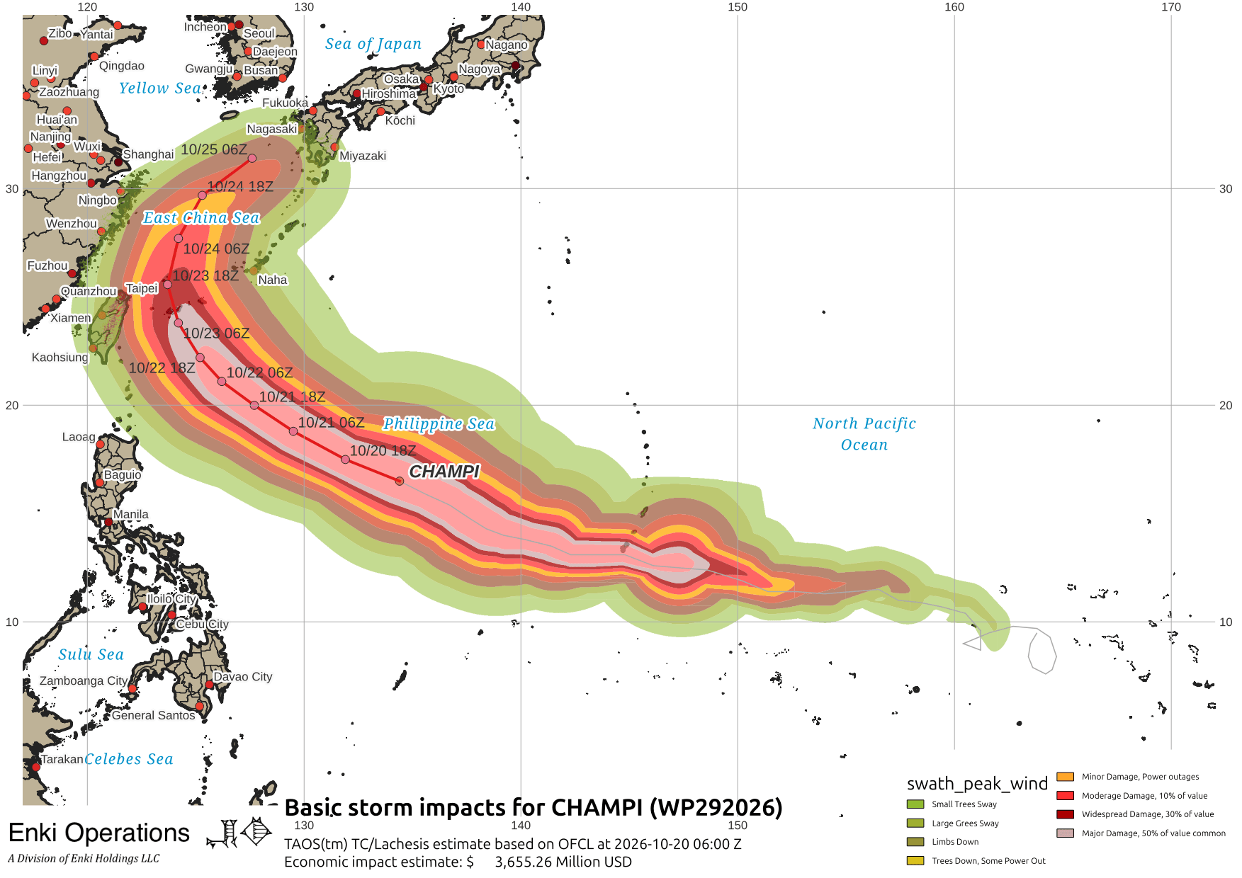
Out in the western Pacific, Super Typhoon Champi is on track to curve just north of Taiwan and across the East China Sea. This may be a problem for Okinawa and Japan later this week.
If you appreciate the blog, the best way to get it is to subscribe to the emails. You can subscribe and also donate to keep it going at this link.
While email subscriptions (which are free) are the best way to get these posts, you can also follow us on Musk’s Madness X/Twitter (@EnkiResearch), Telegram, or BlueSky.