

Interesting tracks for two East Pacific storms. You may recall last week it looked like Hurricane Simon was on the verge of landfall near Guadalajara. Then it looked like Baja, and now it may be caught up in weak steering that will keep it offshore …
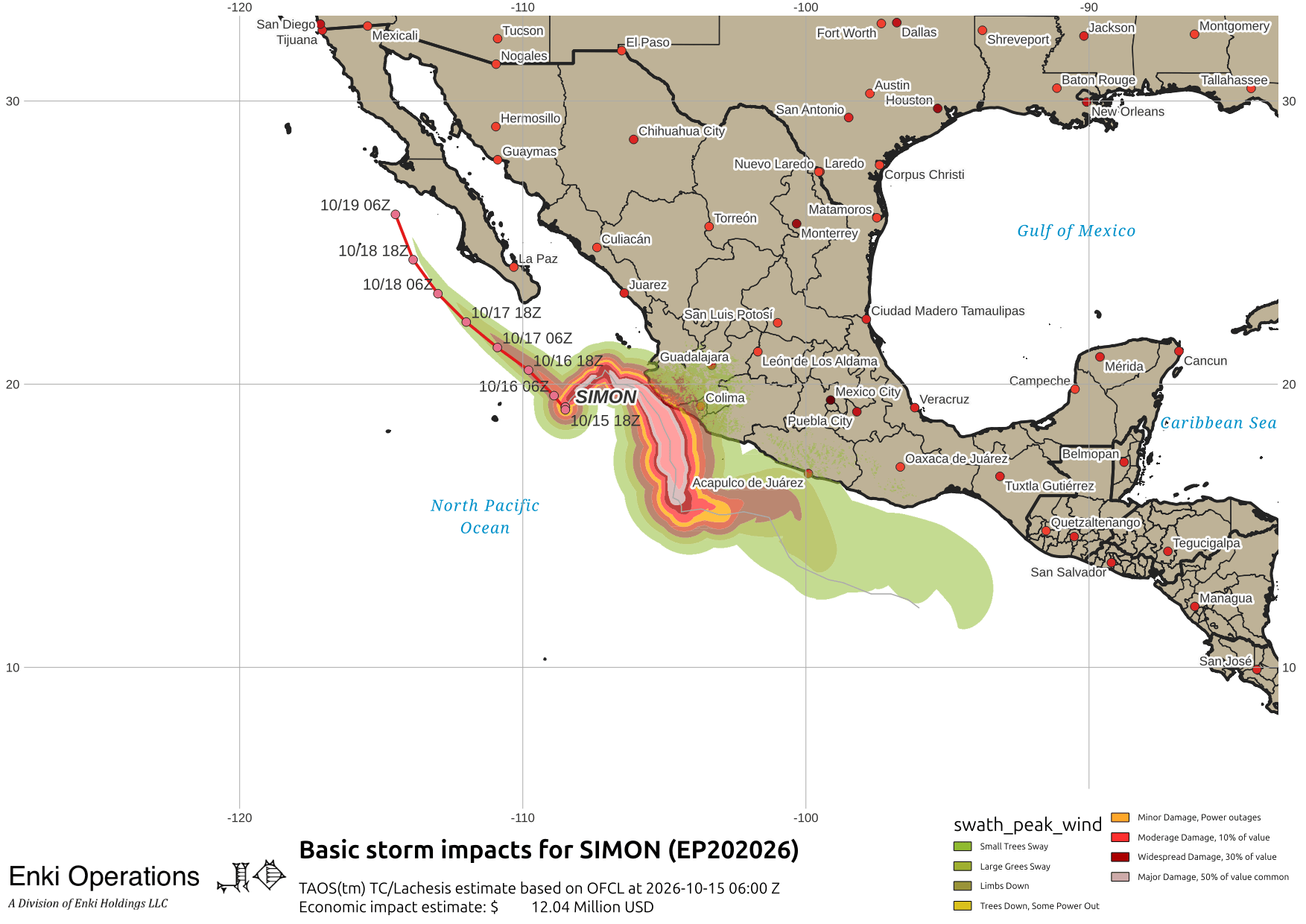
Simon, and before it Rachel, have caused a great deal of flood damage and at least six deaths. There is another storm right behind Simon, Hurricane Trudy …
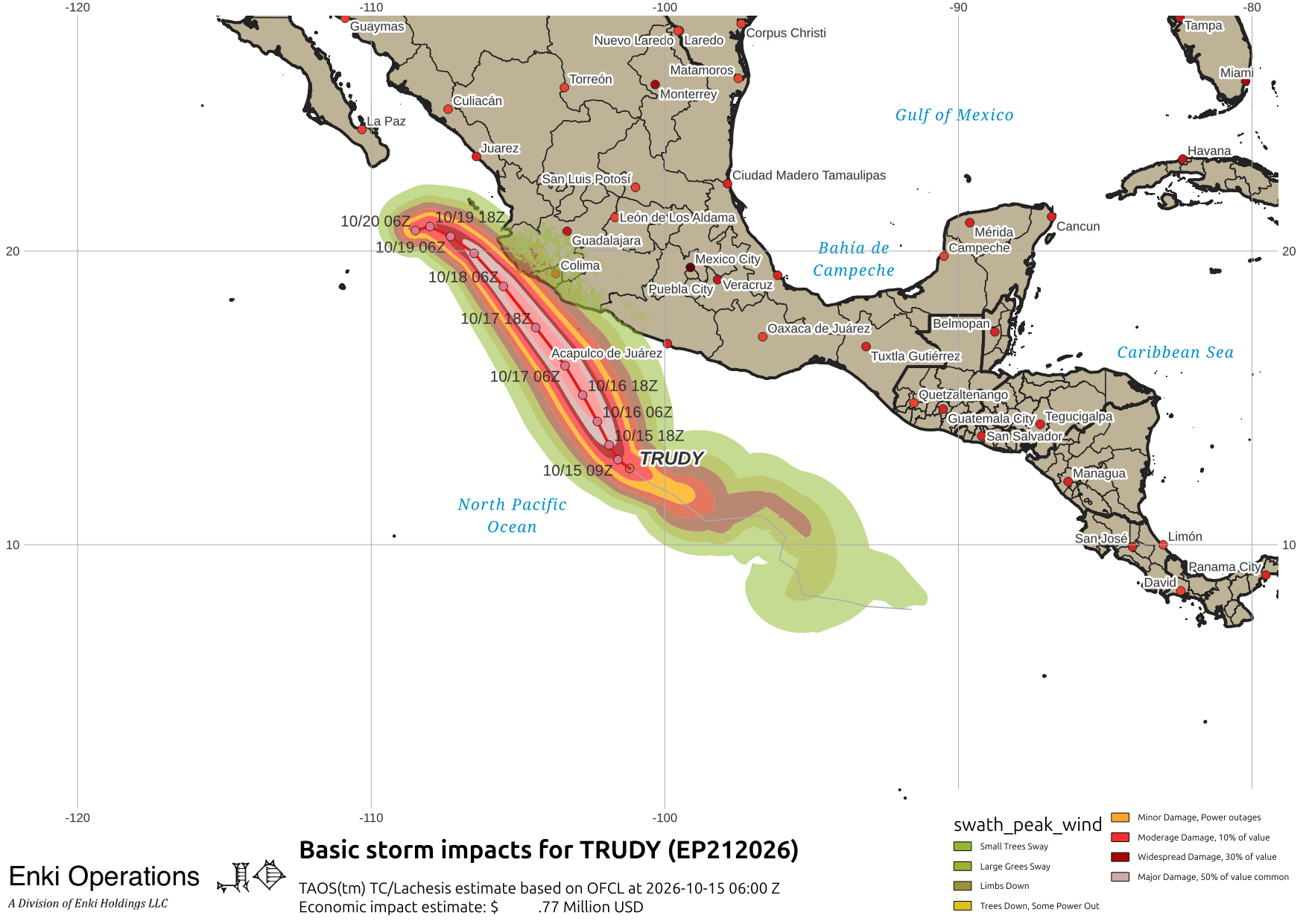
Trudy looks to brush the already damaged coast then curl offshore, following Simon’s path. So what’s going on? If we look at upper level “steering” winds at 30,000ft, we find there is weak northwest (parallel to the Mexican coast) flow, but just to the north lies the increasingly strong jet that typically sets up during El Nino winters …

This jet is what drags winter storms across California, bringing wet Pacific air into the region an dumping lots of rain and snow across the state, often with catastrophic flooding. For our storms that means as they drift north they hit that and, like the remnants of Rachel, end up in the desert southwest.
So why is Simon shown sneaking under that jet? Because it is rapidly weakening and the top of the storm is being torn off and carried northeast while the low level remnants persist in moving northwest.
This shows how intensity and structure work with steering to create interesting combinations, and why the three have to be weighted when looking at forecasts. Some models weight things differently than others or show them evolving differently, which is why you get different track solutions …

If you appreciate the blog, the best way to get it is to subscribe to the emails. You can subscribe and also donate to keep it going at this link.
THANK YOU for the surge in donations over the last week!!!
While email subscriptions (which are free) are the best way to get these posts, you can also follow us on Musk’s Madness X/Twitter (@EnkiResearch), Telegram, or BlueSky.