

Isaias is sweeping north, the last band of heavy rain is just west of the Frogmore Metroplex (Coastal GA/SC Lowcountry), when it sweeps through should be mostly done. But beware, a tornado warning just raised near Sylvania, so still a bit more to go:

Here’s the water vapor view, brown is dry air, you can see the bright white band of rain moving up from the Gulf …

Here’s radar at 2pm …

As of just before 2, there was a tornado warning in Florida, but everywhere else are just watches and advisories (but by 2:30 one cropped up near Sylvania, see above).

Rain continues to accumulate, but far below the initial forecasts at least locally. Here’s the latest totals, the heaviest has stayed offshore. Unless some kind of entrainment sets up in the band, shouldn’t have major problems with this event in the Metroplex.

Otherwise, NHC has discontinued advisories on Isaias. WPC is monitoring the flooding potential and remainder of the rain.

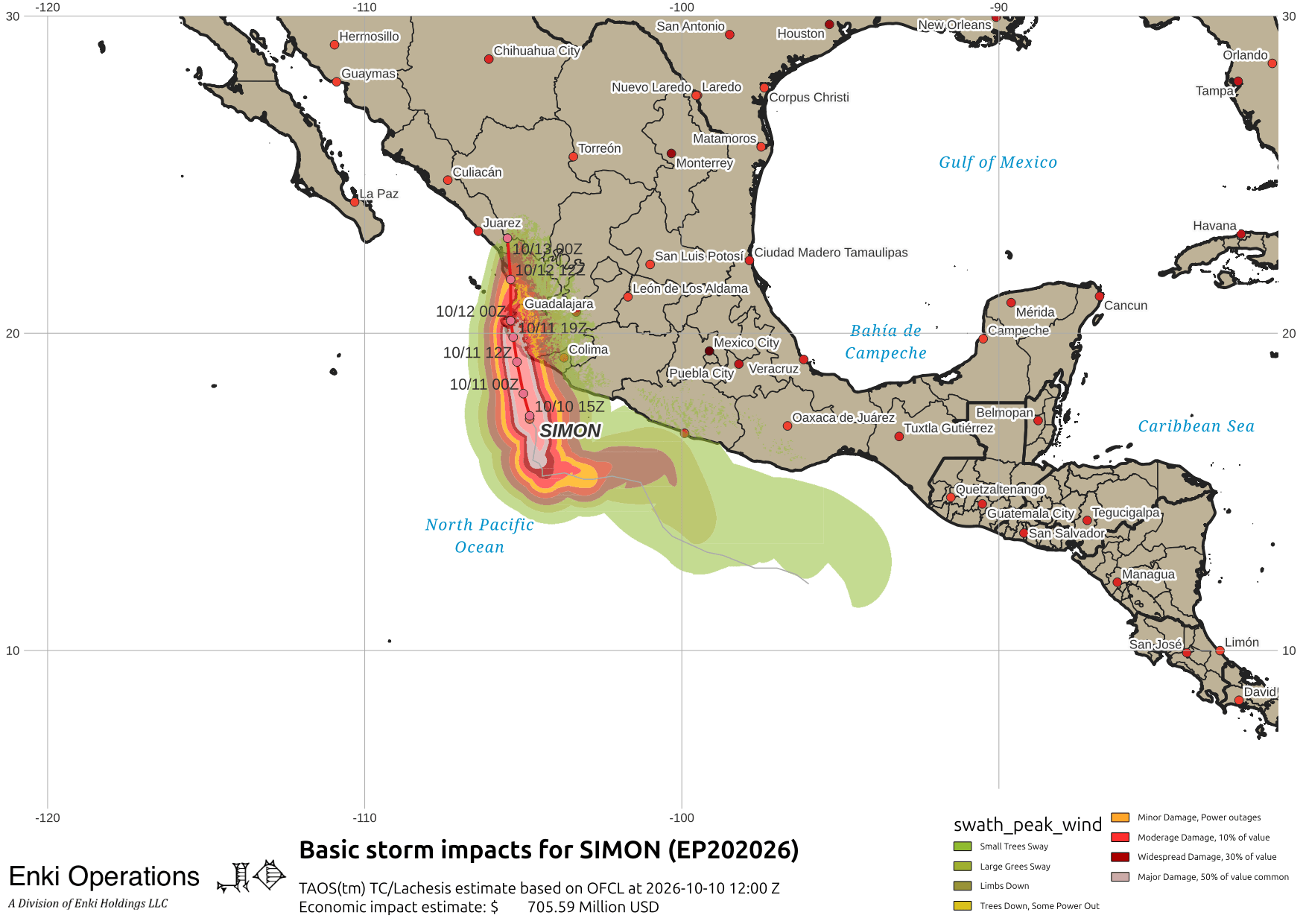
Mexico is facing two landfalls today. Category 4 hurricane Simon is likely to cause major damage around Guadalajara:
Further north, Rachel is an unusual storm. It brushed the coast, headed west, then did a 180 and headed for the Mexican/American border:
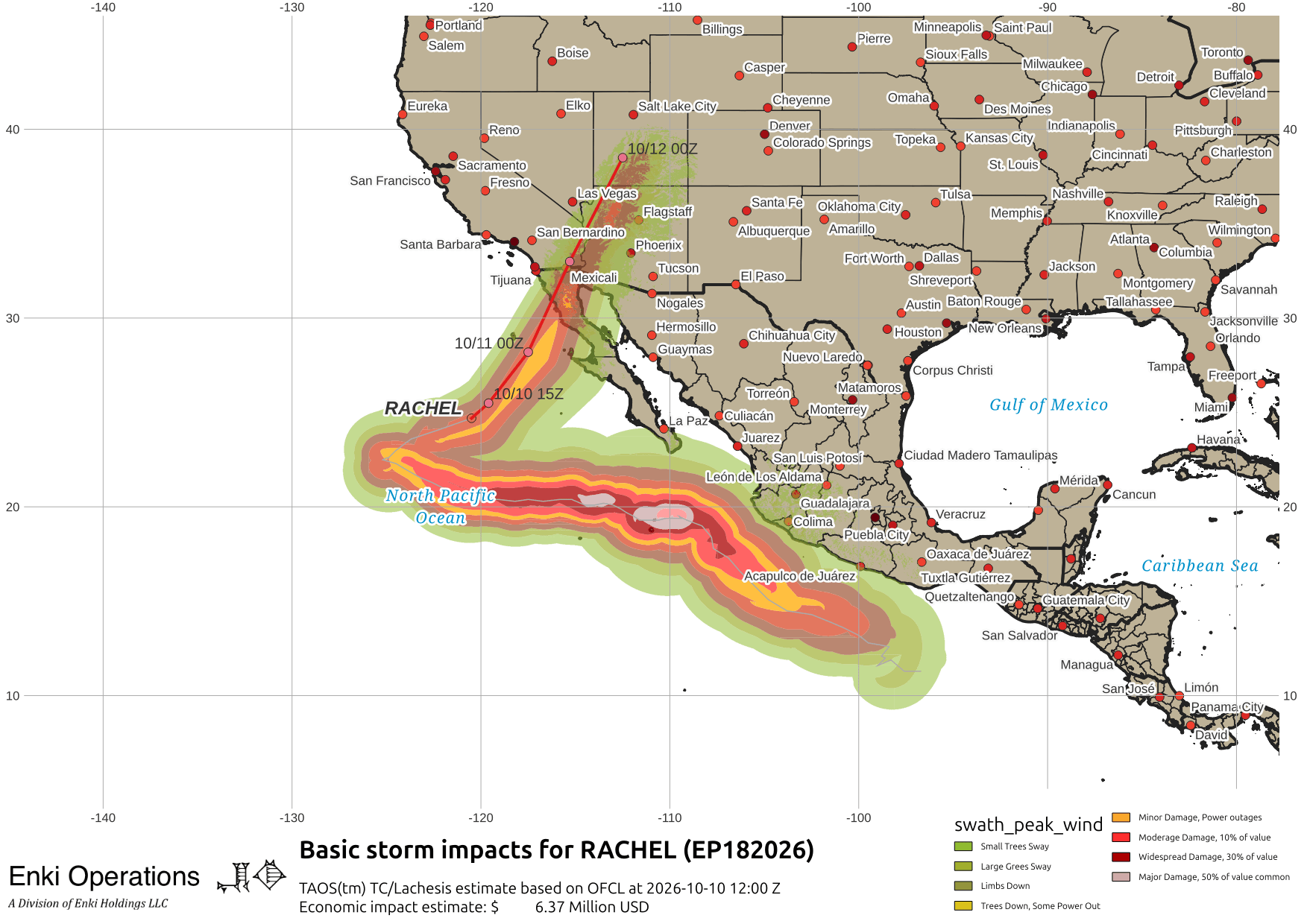
It’s essentially a tropical storm, at this point a swirl of low clouds, but is on track to drag a lot of moisture into the desert southwest. Here’s the visual band view …

And animation of CONUS rainfall over the next five days, showing the trail of rain of all three storms across the US:
That has triggered flood watches and warnings all up the eastern side of the Rockies …

Last update for now, unless something weird happens.
If you appreciate the blog, the best way to get it is to subscribe to the emails. You can subscribe and also donate to keep it going at this link.
THANK YOU for the surge in donations over the last week!!!
While email subscriptions (which are free) are the best way to get these screeds, you can also follow us on Musk’s Madness X/Twitter (@EnkiResearch), Telegram, or BlueSky.