

First an administrative note. GOES-19 (East) is offline, NOAA is working on trying to restore it, no idea what happened at this point or how long it will be offline. Since my big dish ground station is pointed at that orbital slot and not at the backup, GOES-16, having to make do with alternates off the low-bandwidth steerables. (yeah, probably TMI).
In the Atlantic, two blobs are being monitored, but as noted even the Dachshund that barks at moving leaves isn’t excited. The first is off the coast of Africa, NHC has it pegged at 10%. Here is the view from the European Space Agency EUMETSAT 0 Degree satellite …
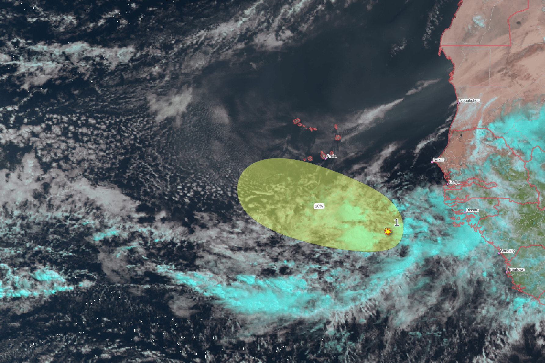
See the brown dust blowing off of Africa? The dust isn’t so much an issue, that just makes the very dry air visible, and it is that dry air that should limit development.
The Gulf blob no chance of spinning up over the next two days, but once the disturbance moves out over the Atlantic it has some chance of spinning up well offshore. There isn’t much to see, here is the radar view this morning of the southeast …

The East Pacific is busy with fish blobs and a new tropical storm, Elida. Mexico, Central America, and Hawaii are all not at risk at the moment (or the foreseeable future).

Some weak disturbances in the West Pacific, JTWC isn’t excited about anything.
As a reminder, here’s a link to my post on the Super-El Nino hype, that seems to surface whenever there’s no other weather dooming to scare you in to clicking.
Any thoughts on the fires in the BWCA and Canada?