

There are two landfalls in progress this morning. Tropical Storm Chantal made landfall on the upper South Carolina coast this morning. Typhoon Danas will make landfall later this afternoon US time (evening in China). Of the two, Chantal isn’t likely to cause a lot of damage, Danas has to potential to cause significant impacts.
Here is Chantal as the sun rises over the east coast of the US, with the warning are highlighed in yellow:

For the official forecast, NHC’s Key messages regarding Tropical Storm Chantal (en Español: Mensajes Claves) is the best overview. Bottom line is that despite the last minute increase in NHC’s peak intensity estimate to 50 knots (58mph) any tropical storm winds will be confined to the immediate coast, and it is unlikely anyone will see sustained winds that high (gusts in thunderstorms might get that high, but we get those on summer thunderstorms all the time). The impact numbers are around $5 Million, a lot of that is due to disruptions from the fact the holiday weekend has been interrupted for the Myrtle Beach area.

The most likely source of problems with Chantal is isolated flash flooding; here is the radar view at just before 7am; you can see the highly asymmetric rain pattern, almost all of the impacts of the storm were on the north side. Fortunately catastrophic flooding like was just seen in Texas is unlikely.

On the other side of the world, Typhoon Danas is about to make landfall on the densely populated western side of Taiwan. Here is the view from Himawari 9 as the sun is setting over the storm (at the same time the sun was rising over Chantal!):
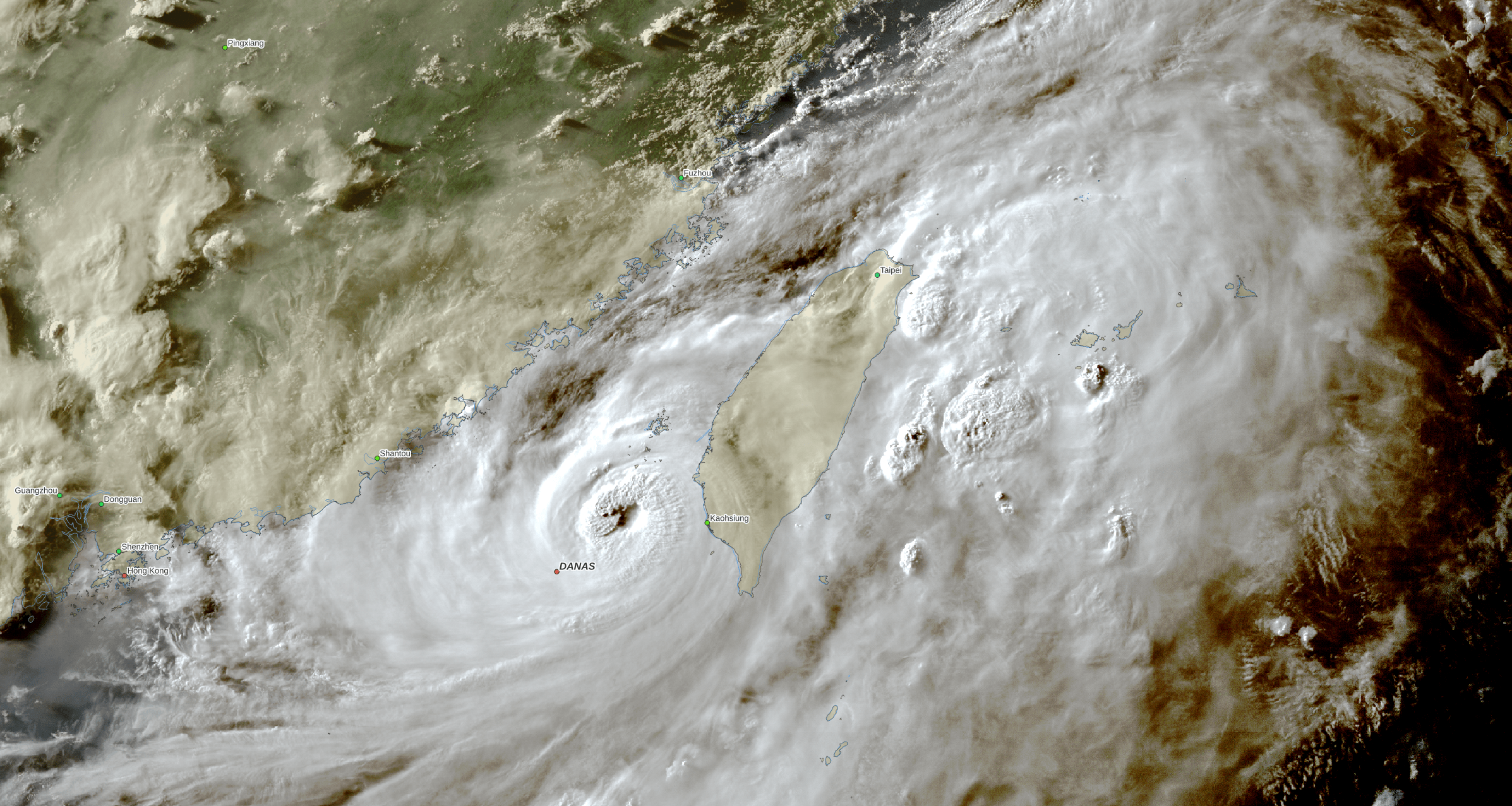
Danas is a much stronger and better organized storm, at least a category 1 hurricane on our Saffir-Simpson scale. The US Joint Typhoon Warning Center has it about 20% stronger than the other agencies such as the Japan Meteorological Agency and the China Meteorological Administration(CMA). Here is the impact estimate based on the JTWC forecast:

That could cause $5 Billion in impacts if the higher estimate holds; otherwise, impacts should “only” be in the $1-$2 Billion range. Here is a radar composite from CMA, notice the much tighter pattern and eye compared to Chantal:

If you like this commentary you can subscribe to the emails (and/or donate to keep it going) at this link. You can also follow us on X/Twitter (@EnkiResearch), Telegram, or even Facebook if that’s your preferred social media dystopia.
Could be some beach erosion also