

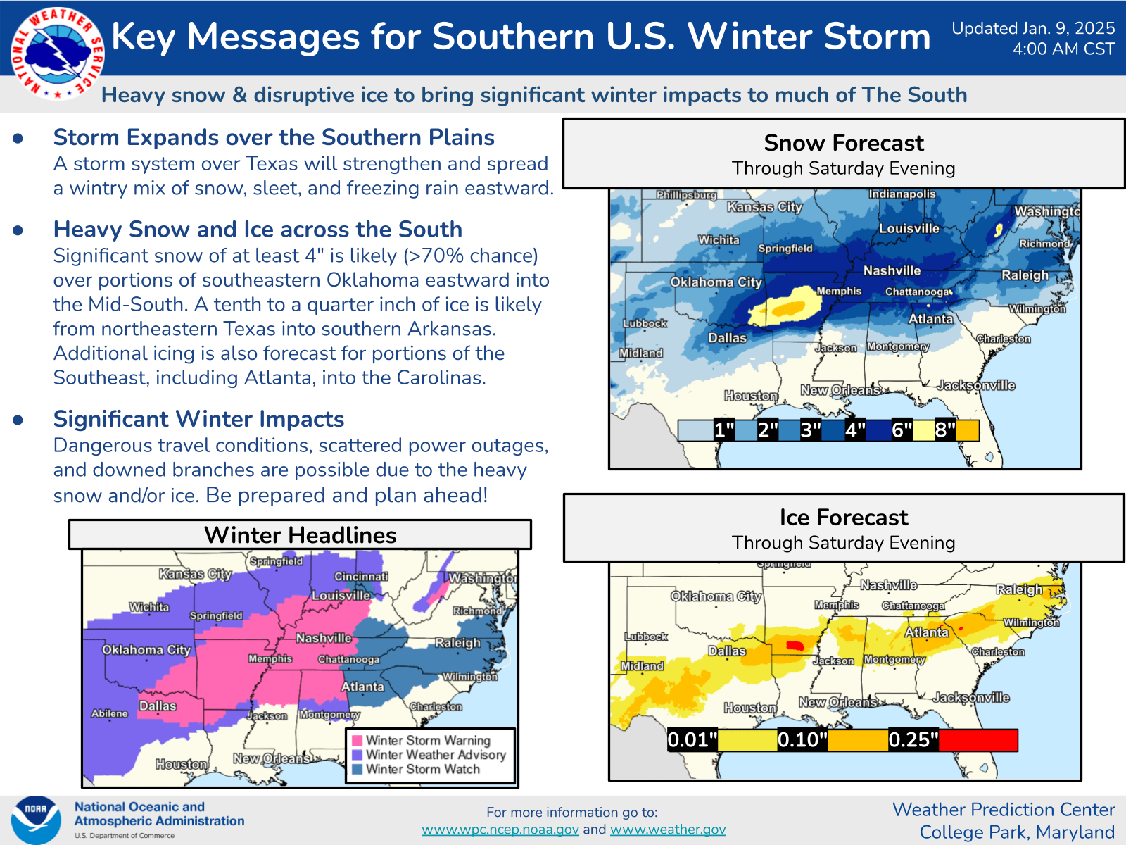
Unfortunately the winter storm that will be Elsa-ing the Southeast tomorrow is shaping up to potentially be more of an ice event. Here are WPC’s latest Key Messages:
Using the NAM-HIRES model and zooming in a bit, here is what it looks in north Georgia at 10am tomorrow … (sorry the legend got clipped, blue is snow, purple is sleet, red is freezing rain/ice, green is rain):

at 4pm …

and 6pm …
across GA/SC
The “big picture” at 10pm looks like this:

Travel tomorrow afternoon in the Atlanta area is likely to be utterly horrific – even by Atlanta standards. The wretched hive of scum and villainy (Hartsfield/Jackson International Airport) and other major airports in the region like Charlottee will likely start to have delays stack up by evening.
So, as of now, it is looking like the snow will be staying in the mountains of AL/GA/NC and points north, and sleet/ice south of that with some occasional snow mixed to taunt you. Those further south who were thinking about a quick trip to see some snow this weekend, this event may not be a good one to try that as there will be a band where the roads will be icy. In addition, we’re looking at ice levels that will at least cause some scattered power outages – and maybe even widespread..
If you like this kind of commentary you can subscribe to the emails (and/or donate to keep it going) at this link. You can also follow us on X/Twitter (@EnkiResearch) or even Facebook if that’s your preferred social media dystopia.